If only Compostela Valley officials heeded government advisory and immediately acted on them, the tragedy that befell the province during the onslaught of Typhoon Pablo (Bopha) last Tuesday could have been avoided, an official of the Department of Environment and Natural Resources (DENR) asserted Thursday. Despite the flood and landslide warnings over several years, many Compostela Valley residents stayed in areas declared “hazard prone” by the government, with the implicit consent of local officials, noted Engr. Leo Jasareno, director of the DENR's Mines and Geosciences Bureau. "Sa case po ng Compostela Valley, marami pong lugar na dineklara na po natin na hazard prone subalit nandoon pa rin ang mga kababayan natin. 'Yun ang naging dahilan kung bakit mataas ang ating casualty," Jasareno said in an interview on GMA News TV's “News to Go” program. He said many areas in Compostela Valley, which suffered the most number of fatalities from the typhoon, are tagged “no man's land” on the DENR's geohazard maps as they are prone to floods and landslides. "Kung no man's land ang lugar, kailangan gawing no man's land,” Jasareno said, adding political will should go hand in hand with information campaigns on the vulnerability of some areas. Based on their analysis, casualties were at a minimum in provinces such as Surigao del Sur and Surigao del Norte, and also in Cagayan de Oro City — areas that Jasareno said heeded the government's advisory. "Sa Compostela Valley, hindi po naaksyunan yung mga advisory ng DENR sa geohazard areas," he said. Denuded forests Compostela Valley Governor Arturo Uy could not be reached for comment on the matter when GMA News Online tried to contact him through his mobile phone. In an interview with GMA News' 24 Oras on Thursday, however, Uy said one of the possible reasons for the flash floods in the province is the denudation in the mountains of New Bataan, one of the hardest hit towns. "Ito noon, logging area ito e, I mean, marami tayong kahoy noon e," he said. GMA News Online also attempted to contact New Bataan Mayor Lorenzo Balbin, Jr. for comment, but he could not be reached on his mobile phone. Telephone signals in the province have been spotty since the typhoon ravaged the area Tuesday. New Bataan is flood-prone area As of Thursday morning, disaster management officials recorded 325 typhoon-related deaths, as rescuers sifted through mud and piles of uprooted trees and destroyed homes in search for the hundreds more that were still missing. At least 101 deaths were reported in New Bataan, and many more were missing. In another interview on dzBB radio, Jasareno said their geohazard maps showed New Bataan was prone to floods.
Text and image from Mines and Geosciences Bureau website
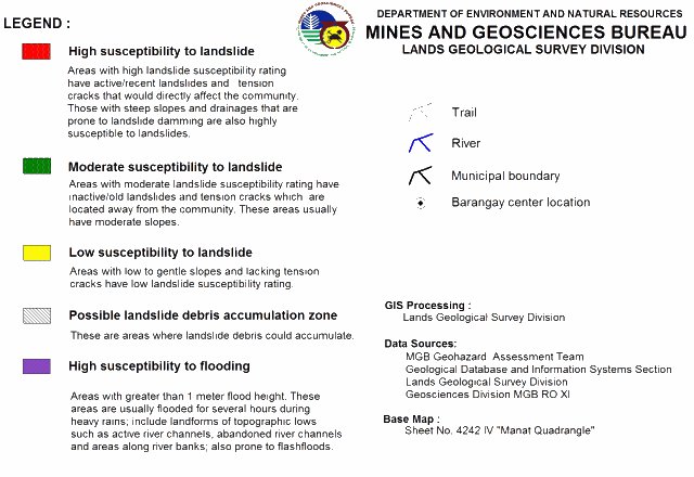
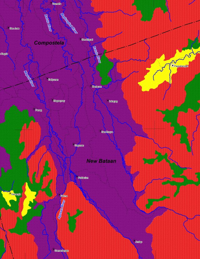
He said that if the local government cannot forcibly evacuate residents, an alternative would be to beef up the early warning system so residents can evacuate at an earlier period. "May 16 barangay sa New Bataan ang nasa flood-prone area. Ibig sabihin niyan, immediate resolution natin, hindi pwede ilipat ang 16 barangay, dapat diyan ay matindi ang early warning system para pag may darating na pag-ulan, pagbagyo magkaroon ng temporary evacuation," he said. He said landslide-prone areas are marked red, while flood-prone areas are marked purple on the DENR geohazard maps. "Kalat-kalat ['yung areas], hindi naman po isang diretsong lugar,” Jasareno said, adding that local government officials are aware of the classifications of these areas. Based on the DENR-MGB geohazard assessment in 2006, 25 percent of Compostela Valley are considered high risk areas for landslides, while 23 percent are high risk areas for flooding. In New Bataan, 38 percent of the barangays are at high risk for landslides, while 44 percent are at high risk for flooding. Outside New Bataan, more than 60 villages in the province are considered landslide-prone, Jasareno said on dzBB. According to data from GMA News Research, there have been 11 landslides in Compostela Valley in the past nine years, excluding those caused by Typhoon Pablo. Last January, in the wake of a
landslide that killed 25 residents in Pantukan town, Governor Uy had said the local government had warned residents against landslides, but many sneaked back into their homes despite the danger. Jasareno told “News To Go” that flood-prone areas in Compostela Valley are low-lying areas, while those prone to landslide are mountainous areas with steep slopes and highly weathered areas, including denuded forests.
Mining made it worse Mining operations in the area had worsened the situation, Jasareno added. "Maraming lugar landslide-prone pero may nagbubutas na minero, small-scale miners." He said in Compostela Valley, there are only one or two large-scale mining operations with contracts, while the rest are undocumented small-scale operations, mostly located in landslide-prone areas. "Wala ho silang mga permit at sa madaling sabi ay illegal. Karamihan po diyan ay nakalugar sa natural na landslide-prone areas," Jasareno said. He also said the national government has already issued proper advisory regarding this matter, and that local officials had received copies of the geohazard maps. "Bukod sa pagkalat ng mapa, taun-taon may information campaign hanggang sa level ng munisipyo para ipaliwanag anong gagawin kung may pag-ulan ," he said on dzBB. "Lahat ng munisipyo sa buong Pilipinas ay mayroon nang mga geohazard maps at alam po nila yung mga danger zone na 'yan. Ganun din po yung mga relocation sites, alam na po nila yan," Jasareno said on “News To Go.” Jasareno also noted that Typhoon Pablo, which has since weakened into a tropical storm, ravaged areas that do not normally experience cyclones. "Matagal na pong panahon na nagkaroon ng bagyo diyan. Kung itong bagyo ay dumaan sa Bicol, Samar o Cagayan, iba po siguro ang naging resulta kaysa sa nangyari ngayon," he said.
— Carmela G. Lapeña & Gian Geronimo/KBK/YA/HS, GMA News