
Tropical Depression Onyok now in PAR

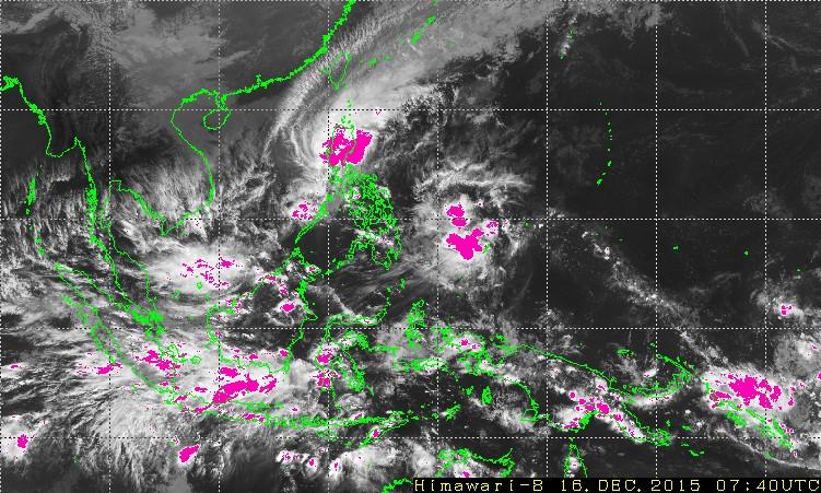
The Japan Meteorological Agency's Himawari satellite as of 3:40 p.m. Wednesday shows Tropical Depression Onyok far east of Mindanao, while Typhoon Nona continues to rain on Luzon.
Even as the Philippines still reels from the effects of Typhoon Nona (Melor), a new potential cyclone has just entered the Philippine Area of Responsibility (PAR) and is being monitored by international weather agencies for further developments.
PAGASA gave the tropical depression (TD) the local codename "Onyok," but assured that it is still too far and too weak to directly affect the country.
However, it remains to be seen just how powerful the disturbance may become. Forecasters expressed hope that the cold Amihan winds may stifle the TD before it nears the Philippines.
Otherwise, the TD may make for a rainy weekend in Visayas and Mindanao.
"Posible itong lumapit at magpaulan sa Eastern Visayas at Mindanao pagdating ng Biyernes. Pero posible rin itong humina at maging Low Pressure Area dahil sa paglakas ng Amihan," explained GMA resident meteorologist Nathaniel "Mang Tani" Cruz.
As of 3 p.m. Wednesday, the Japan Meteorological Agency (JMA) posited Onyok just off the coast of Palau, having crossed the PAR's easternmost border at a fast clip of 30 kph.
The US' Joint Typhoon Warning Center (JTWC) said that the potential is high that Onyok may develop into a significant cyclone within 24 hours, but there was no need yet to issue tropical cyclone warnings.
Onyok's entry comes on the heels of Nona's departure from the Philippines earlier in the day.