
Fabian continues west northwest movement; southwest monsoon to bring monsoon rains over parts of Luzon
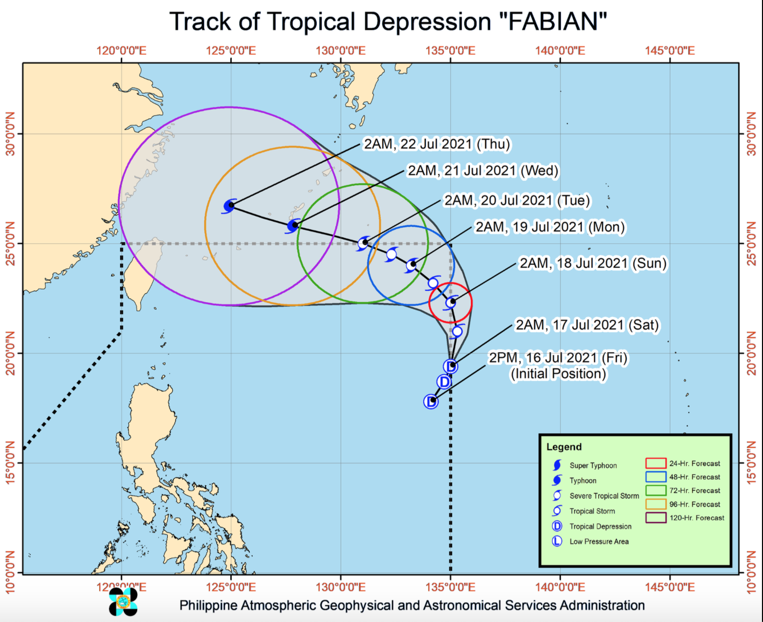
As of 3 a.m. on Tuesday, the center of Severe Tropical Storm Fabian was estimated at 1,035 kilometers east northeast of extreme northern Luzon with maximum sustained winds of 95 kilometers per hour near the center and gustiness of up to 115 kph.
Fabian is slowly moving in the west northwest direction. The southwest monsoon, meanwhile, will be affecting the country, PAGASA reported.
Ilocos Region, Cordillera Administrative Region, Cagayan Valley, Zambales, Bataan, Occidental Mindoro, and Palawan will have monsoon rains brought about by the southwest monsoon with possible flash floods or landslides due to scattered to widespread moderate to at times heavy rains.
Metro Manila, CALABARZON, the rest of MIMAROPA, and Western Visayas will have cloudy skies with scattered rainshowers and thunderstorms due to the southwest monsoon with possible flash floods or landslides during moderate to at times heavy rains.
The rest of the country will have partly cloudy to cloudy skies with rainshowers or thunderstorms due to the southwest monsoon with possible flash floods or landslides during severe thunderstorms.
The weather bureau is also monitoring an active Tropical Cyclone outside the Philippine Area of Responsibility. As of 3 a.m., Typhoon Cempaka is 960 kilometers west of extreme northern Luzon with maximum sustained winds of 120 kilometers per hour near the center with gustiness of up to 150 kph and moving slowly westward.
The northern and western section of Luzon will experience moderate to strong wind speed moving southwestward while coastal waters will be moderate to strong.
The rest of the country will experience light to moderate wind speed moving southwestward while coastal waters will be slight to moderate.
The sun will rise by 5:36 a.m. and set by 6:29 p.m.
In the next 24 hours, under the influence of the Southwest Monsoon enhanced by both Fabian and Cempaka, rough to very rough seas may be experienced over the seaboards of Batanes and Babuyan Islands, and the western seaboard of Palawan (including Kalayaan and Calamian Islands) and Occidental Mindoro (including Lubang Islands).
Sea travel is risky for small seacrafts over these waters. Mariners without the proper experience should immediately seek safe harbor.
Meanwhile, Fabian is forecast to further intensify and reach typhoon category tonight or tomorrow early morning. The tropical cyclone may reach its peak intensity of 150 kph on Thursday and gradually weaken by Friday evening or Saturday morning. -- BAP, GMA News
