
Fabian intensifies into typhoon; southwest monsoon to bring rains over parts of Luzon
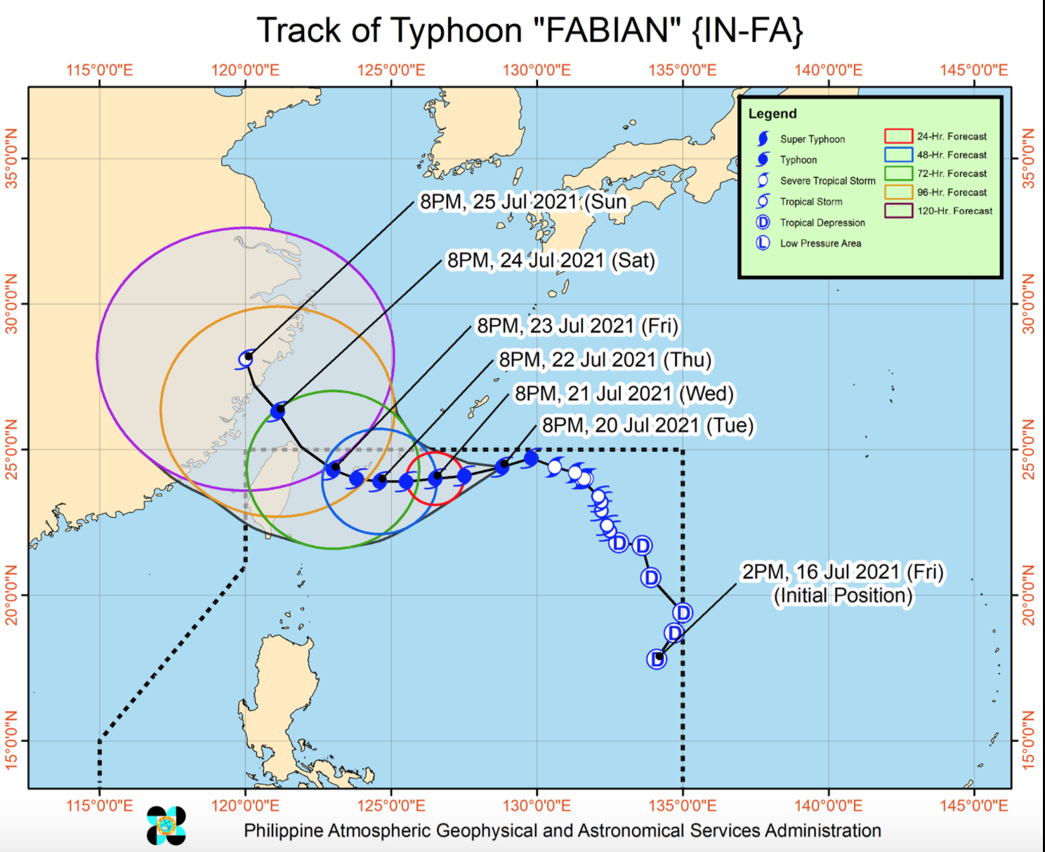
The center of the eye of Typhoon Fabian was estimated at 895 kilometers east northeast of extreme northern Luzon with maximum sustained winds of 120 kilometers per hour near the center, gustiness of up to 150 kph, and central pressure of 975 hPa and moving west Northwestward at 15 kph.
The weather bureau also reported that there would be strong winds or higher extending outwards up to 600 kilometers from the center.
Typhoon Fabian is unlikely to bring heavy rainfall in the country throughout the forecast period and is under the influence of the southwest monsoon that is being enhanced by Fabian and Typhoon Cempaka estimated at 985 kilometers west of extreme northern Luzon outside the Philippine Area of Responsibility (PAR).
Monsoon rains will be experienced in the next 24 hours over Metro Manila, Ilocos Region, Cordillera Administrative Region, Zambales, Bataan, Pampanga, Cavite, Batangas, Occidental Mindoro, northern Palawan (including Calamian and Cuyo Islands), Batanes, and Babuyan Islands.
Fabian is likely that Tropical Cyclone Wind Signal No. 1 may be hoisted over Batanes and Babuyan Islands.
In the next 24 hours, under the influence of the southwest monsoon enhanced by both Fabian and Cempaka, rough to very rough seas may be experienced over the seaboards of Batanes, the northern seaboard of Cagayan (including Babuyan Islands), and the western seaboard of Palawan (including Kalayaan and Calamian Islands) and Occidental Mindoro (including Lubang Islands).
Sea travel is risky for small seacrafts over these waters. Mariners without the proper experience should immediately seek safe harbor.
Fabian will move generally westward until Friday and landfall may occur in the vicinity of northern Taiwan by Friday evening or Saturday early morning and exit PAR. -- BAP, GMA News
