
Queenie to bring moderate to heavy rains over Surigao, Dinagat Islands
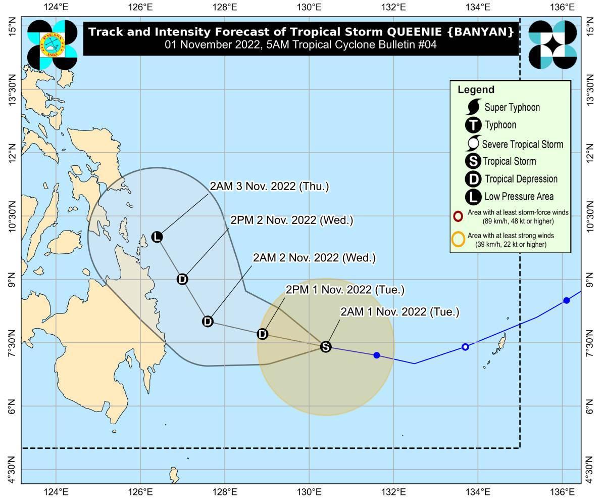
Tropical Storm Queenie (international name: Banyan) is moving westward over the Philippine Sea east of Mindanao on Tuesday and may bring rains over Surigao del Norte, Surigao del Sur, and Dinagat Islands, PAGASA said in its bulletin.
These three areas may have moderate to heavy rains starting Tuesday night until Wednesday.
Meanwhile, Eastern Visayas, Davao Oriental, and the rest of Caraga Region may expect light to moderate with at times heavy rains.
No tropical cyclone wind signals were raised so far.
At 4 a.m, the center of Queenie was estimated to be located at 490 km east of Davao City, with maximum sustained winds of 65 km/h near the center, gustiness of up to 80 km/h, and central pressure of 1000 hPa.
Queenie is moving westward at 20 km/h.
From its center, strong to gale-force winds are extending outwards up to 180 km.
On Thursday, Caraga, Davao Region, Northern Mindanao, Eastern Visayas, Central Visayas, and Bicol Region may have light to moderate with at times heavy rains.
PAGASA said flooding and rain-induced landslides may result especially in areas prone to these hazards or in localities which had significant amount of rain in previous days.
Coastal waters will be moderate to rough in the next 24 hours over the eastern seaboard of Mindanao, with waves possibly reaching up to 3 meters tall.
"These conditions may be risky for those using small seacrafts. Mariners are advised to take precautionary measures when venturing out to sea and, if possible, avoid navigating in these conditions," PAGASA said.
Track, intensity outlook
Queenie is expected to continue going west northwestward to northwestward on Tuesday, then will turn north northwestward on Wednesday while over the sea east of the Caraga-Davao Region area.
PAGASA said Queenie may weaken into a tropical depression on Tuesday, then further possibly weaken into a low pressure area by Thursday or earlier.
The weather bureau advised the public and disaster risk reduction and management offices concerned to take all necessary measures to protect life and property.
The next bulletin will be issued by PAGASA at 11 a.m.
Preparations
The local government of Surigao City said it is ready for the possible onslaught of Queenie.
The City Disaster Risk Reduction and Management Office is monitoring the weather condition 24/7 to enable quick response, and the government is looking into conducting preemptive evacuation in flood-prone areas, authorities said.
Queenie came as many areas in the Philippines were reeling from the effects of Severe Tropical Storm Paeng, which has left 73 people dead as of Monday night. —KG, GMA News
