
Rosal intensifies, moves northeastward away from the country
Tropical Storm Rosal (international name: Pakhar) further intensified on Monday as it continued moving northeastward away from the country, PAGASA said in its bulletin.
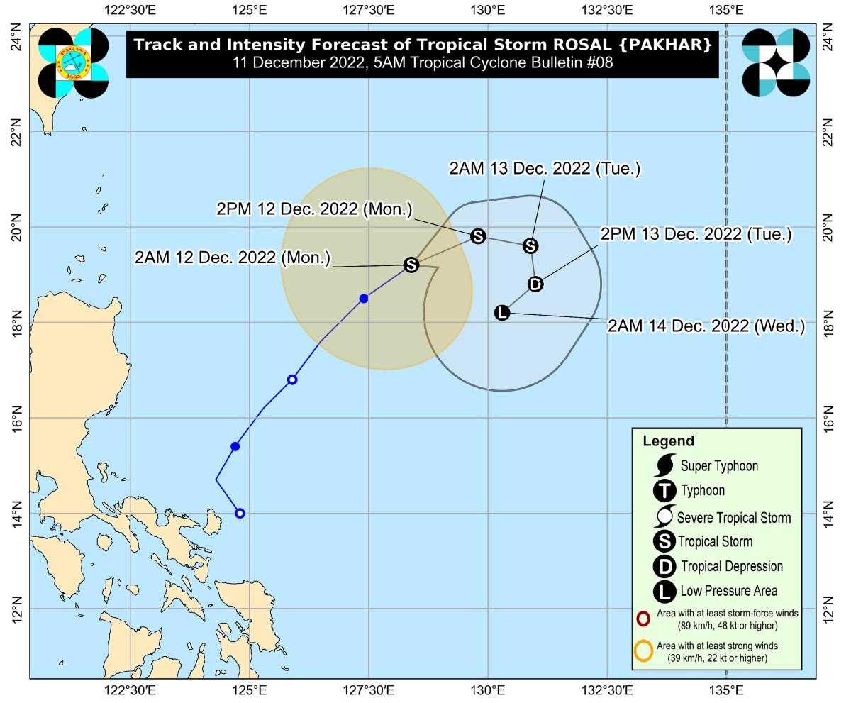
At 4 a.m., the center of Rosal was estimated to be located at 770 km east of Calayan, Cagayan.
Rosal has maximum sustained winds of 85 km/h near the center, gustiness of up to 105 km/h, and central pressure of 994 hPa.
It is moving northeastward at 20 km/h.
From the tropical storm's center, strong to gale-force winds are extending outwards up to 280 km.
PAGASA did not raise any tropical cyclone wind signals.
"Rosal is less likely to directly bring heavy rains (which may trigger flooding or rain-induced landslides) in the country throughout the forecast period," PAGASA said.
As for winds, occasional gusts reaching gale-force strength may be expected over Batanes in the next 24 hours due to the surge of the Northeast Monsoon partly enhanced by Rosal.
Strong breeze to near-gale strength winds on the other hand may be felt in Babuyan Islands and the coastal and upland areas of Ilocos Norte, northern and eastern Cagayan, and eastern Isabela.
A marine gale warning was raised over the seaboards of Northern Luzon due to the surge of the Northeast Monsoon partly enhanced by the tropical storm.
Coastal waters will be moderate to rough over the seaboards of Central Luzon and the eastern and western seaboards of Southern Luzon in the next 24 hours due to the combined effects of the monsoon's surge and Rosal.
"These conditions may be risky for those using small seacrafts. Mariners are advised to take precautionary measures when venturing out to sea and, if possible, avoid navigating in these conditions," PAGASA said.
Track, intensity
The weather bureau said Rosal is expected to move generally northeastward until Monday afternoon, then turn eastward for the remainder of the day.
Rosal is also expected to remain at its present intensity on Monday but a slight intensification is not being ruled out.
By Tuesday, the storm will start encountering increasingly unfavorable conditions due to the surge of the Northeast Monsoon, and this may lead to Rosal's rapid weakening and a southward to southwestward turn in its direction.
Rosal may become a remnant low pressure area on Tuesday evening or on Wednesday early morning, then dissipate shortly after.
PAGASA advised the public and disaster risk reduction and management offices concerned to take all necessary measures to protect life and property.
Those living in areas prone to hazards are advised to follow evacuation and other instructions from local government units.
PAGASA will issue the next tropical cyclone bulletin at 11 a.m. —KG, GMA Integrated News
