
Signal No. 1 up in 19 areas as Amang maintains strength
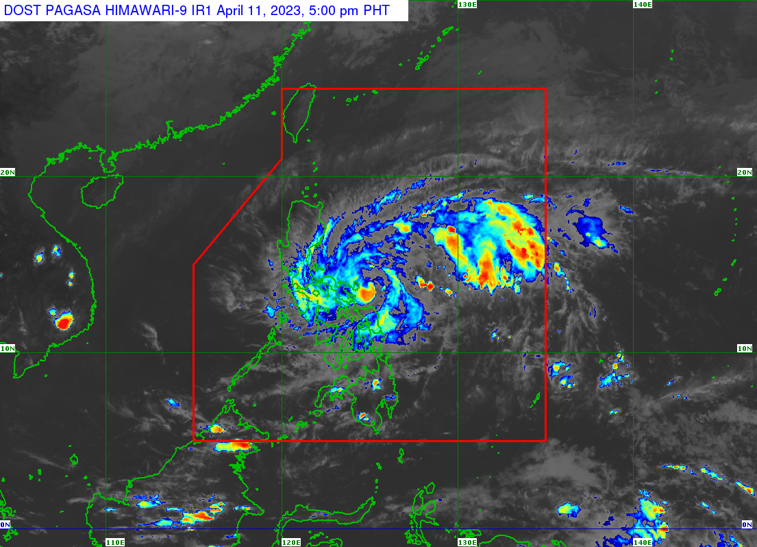
Signal No. 1 has been hoisted over 19 areas as Tropical Depression Amang maintains its strength and continues to head toward the northern coast of Catanduanes, PAGASA said Monday.
In its 5 p.m. bulletin, the state weather bureau said Tropical Cyclone Wind Signal (TCWS) No. 1 is hoisted over the following areas:
Luzon
- Catanduanes
- Sorsogon
- Albay
- Camarines Sur
- Camarines Norte
- Quezon including Pollilo Islands
- Marinduque
- Masbate including Ticao Island, Burias Island
- Rizal
- Laguna (San Pablo City, Alaminos, Calauan, Bay, Los Baños, Rizal, Nagcarlan, Victoria, Pila, Liliw, Magdalena, Majayjay, Luisiana, Cavinti, Pagsanjan, Santa Cruz, Lumban, Kalayaan, Paete, Pakil, Pangil, Siniloan, Famy, Santa Maria, Mabitac)
- Aurora
- Bulacan (Norzagaray, Doña Remedios Trinidad, San Miguel, San Ildefonso)
- Quirino
- Nueva Vizcay (Kasibu, Dupax del Norte, Dupax del Sur, Alfonso Castaneda)
- Nueva Ecija (General Tinio, City of Gapan, Peñaranda, San Leonardo, Santa Rosa, Cabanatuan City, Talavera, San Jose City, Carranglan, Pantabangan, Llanera, General Mamerto Natividad, Rizal, Bongabon, Laur, Palayan City, Gabaldon)
- Isabela (Echague, San Agustin, Jones, Dinapigue, San Mariano, San Guillermo, Palanan, Angadanan, Benito Soliven, City of Cauayan)
Visayas
- Northern Samar
- Samar (Calbayog City, Matuguinao, San Jose de Buan, Gandara, Santa Margarita, San Jorge)
- Eastern Samar (Jipapad, Maslog, Arteche, Oras, San Policarpo, Dolores)
As of 3 p.m., the center of the eye of the tropical depression was last seen 130 kilometers east-northeast of Virac, Catanduanes, or 250 km east of Daet, Camarines Norte.
Rainfall warnings were issued in parts of Luzon, Bicol, and Visayas region with heavy rains (50-100 mm) expected in Rizal, Bicol, Northern Samar, the southern portion of Aurora, the rest of Laguna, and Quezon. Intense rains (50-100 mm) were forecast in the northern portion of Quezon and the eastern portion of Laguna.
“Under these conditions, flooding and rain-induced landslides are possible, especially in areas that are highly or very highly susceptible to these hazard as identified in hazard maps and in localities that experienced considerable amounts of rainfall for the past several days,” said PAGASA.
Meanwhile, a marine gale warning is in effect over Catanduanes, the eastern coasts of Albay and Sorsogon, and the northern and eastern coasts of Northern Samar and Eastern Samar.
“In the next 24 hours, moderate to rough seas (1.2 to 2.8 m) over the eastern seaboards of Central Luzon, Southern Luzon, and Eastern Visayas that are not under any gale warning. Mariners of small seacrafts are advised to take precautionary measures when venturing out to sea and, if possible, avoid navigating in these conditions,” the agency added.
Amang is expected to remain a tropical depression throughout the forecast period, with the possibility of weakening into a low-pressure area by late Thursday or early Friday.
It is seen to track generally westward or west-northwestward towards Bicol Region before turning west-northwestward or northwestward for the remainder of the forecast period.
While the current track forecast shows that it will remain offshore over the waters east of Luzon for the next three days, PAGASA said that the tropical depression may make landfall over the Bicol Peninsula area within the next nine hours. — Sundy Locus/BM, GMA Integrated News
