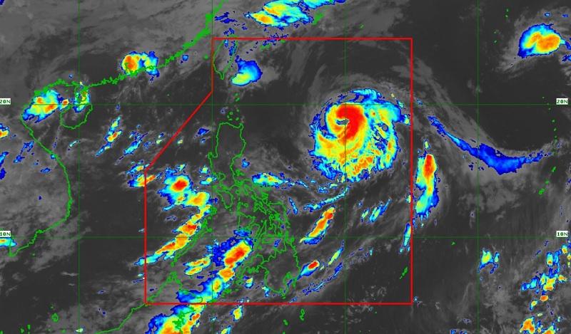
Chedeng intensifies in the middle of the Philippine Sea, not likely to bring heavy rainfall

Typhoon Chedeng (international name: Guchol) intensified in the middle of the Philippine Sea and is not likely to bring heavy rainfall over the country, PAGASA reported in its Tropical Cyclone Bulletin issued early Saturday morning.
As of 4 a.m., the center of the eye of Typhoon Chedeng was estimated to be located at 875 kilometers east of Northern Luzon packing maximum sustained winds of 150 kilometers per hour near the center, gustiness of up to 185 km/h, and central pressure of 955 hPa.
Chedeng is moving north northwestward slowly with strong to typhoon-force winds extending outwards up to 520 km from the center.
Hazards affecting land areas
Chedeng is unlikely to directly bring heavy rainfall over the country in the next three days. But the Southwest Monsoon may be enhanced by Chedeng and bring occasional rains over the western portions of Luzon and Visayas in the next three days.
Metro Manila, Pangasinan, Zambales, Bataan, Cavite, Batangas, Occidental Mindoro, Palawan, and Western Visayas will have cloudy skies with scattered rain showers and thunderstorms due to the southwest monsoon. Flash floods or landslides may occur in these areas due to moderate to at times heavy rains.
The rest of the country will have partly cloudy to cloudy skies with isolated rain showers or thunderstorms due to the southwest monsoon and localized thunderstorms with possible flash floods or landslides occurring during severe thunderstorms.
Severe winds
There are no Tropical Cyclone Wind Signals hoisted at this time, PAGASA said.
But the enhancement of the southwest monsoon over the next three days may bring gusty conditions over the following areas on Saturday: Metro Manila, Calabarzon, Mimaropa, Bicol Region, Visayas, Zambales, Bataan, Camiguin, and Dinagat Islands.
Hazards affecting coastal waters
PAGASA reported that in the next 24 hours, Chedeng may bring moderate to rough seas over the seaboards of extreme Northern Luzon and the eastern seaboard of mainland Northern Luzon so mariners of small seacraft should take precautionary measures.
Track and intensity outlook
The typhoon will remain far from the Philippine landmass and forecasted to move northward or north northeastward on Saturday.
On Sunday, Chedeng will accelerate northeastward towards the sea southeast and east of the Ryukyu Islands and leave the Philippine Area of Responsibility (PAR) between late evening or Monday early morning. —BAP/KG, GMA Integrated News


