


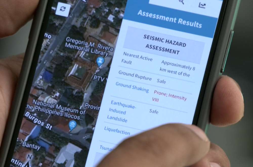
Residents of Ilocos Sur now have access to an online portal that identifies hazardous areas, an initiative that aims to aid in disaster preparedness efforts.
The website, georisk.gov.ph, has been included in the province's disaster readiness initiatives.
Through a memorandum of agreement between the provincial government and the Department of Science and Technology (DOST), local government units (LGUs) are granted permission to manage the website's content.
The platform hosts four applications: Hazard Hunter PH, Geo Analytics PH, Geo Mapper PH, and 3D Earth Risk and Plan Smart App.
LGU personnel have undergone training on effective use of the apps.
“Binibigyan tayo ng opportunity to control yung mga app na ‘yun, and at the same time, magbibigay din tayo ng mga information like [sa] population, kasi ang Georisk PH is yung base nila ng population is 2015," Ron Arquelada, the officer of the Ilocos Sur Provincial Disaster Risk Reduction and Management Council (PDRRMC), said.