


Sinkholes act as natural recharge points for groundwater, allowing surface water to flow into the subsurface, according to the Mines and Geosciences Bureau (MGB) in an inventory of sinkholes in San Remigio and Daanbantayan, Cebu.
MGB conducted a sinkhole inventory in the Municipalities of San Remigio and Daanbantayan, following the magnitude 6.9 earthquake that rocked northern Cebu.
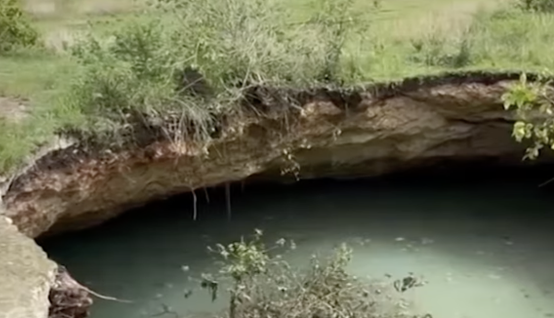
“These new sinkholes give us a rare glimpse into what lies beneath the ground surface,” said MGB in a post on Thursday, October 9, 2025.
MGB cited that sinkholes, particularly those of the cover-collapse type, form when the “ground surface suddenly collapses into underlying voids or cavities.”
“This process can expose caves, which are often part of a larger, interconnected subsurface network. When a sinkhole forms above an aquifer containing water, it is referred to as a cenote, which exposes a deep depression filled with clear, turquoise blue water,” MGB said.
The groundwater in these aquifers, MGB added, often resurfaces as karst springs, providing a vital source of water for local communities.
Further, MGB pointed out that sinkholes act as “natural recharge points for groundwater, allowing surface water to flow into the subsurface.”
However, MGB added, because infiltration through sinkholes occurs rapidly, pollutants can easily enter and spread through underground aquifers.
“This makes karst systems highly vulnerable to contamination. In simple terms, sinkholes aren’t bottomless pits, they’re direct pipelines to the water we use regularly. Throwing trash into them is like pouring waste directly into your own water supply. The contamination of the groundwater poses severe health risks to the communities,” MGB stressed.
MGB urged local officials to impose stricter measures that would keep the environment and groundwater in sinkholes clean.
OVER 30 SINKHOLES
According to a "24 Oras Weekend" report by Ian Cruz on October 4, 2025, San Remigio Mayor Mariano Martinez said 32 sinkholes have been found in their municipality and that the number could still rise.
“We cover them, or just declare the areas unsafe. But the problem is there are already buildings,” Martinez said.
In Sitio Sansan, Barangay Maño, one large hole was filled with water, while two smaller ones can be seen nearby. A sinkhole was also spotted by the sea.
A large sinkhole also emerged beside a residential area. The family fortunately managed to escape amid the earthquake, the report added.
A sinkhole was also found in Sitio Mayjo, Barangay Paypay, Daanbantayan.
A team from the Philippine Institute of Volcanology and Seismology (PHIVOLCS) has been conducting mapping of the Bogo Bay Fault, which generated the strong earthquake that killed at least 70 people and injured more than 500.
NO-BUILD ZONE
After the discovery of the Bogo Bay Fault that generated the magnitude 6.9 offshore earthquake, clearing of the area from permanent residences and structures has been recommended.
According to PHIVOLCS, five meters on each side of the fault line must be cleared.
The fault line is located in Barangay Nailon (na-ee-lon), Barangay Dakit, and Barangay La Paz in Bogo City. PHIVOLCS will delve further into its investigation.
"Alam na natin yung ensaktong location, ang nire-recommend namin within the 5-meter buffer zone, five (5) meters to the left and right yun ang nirerecommend namin na ‘wag na’ng magtayo ng istraktura, marami pong bahay ang natamaan ng fault, so sana ‘wag na po silang bumalik yung mga residente na na-transmit ng fault,” Leo Llamas, member of PHIVOLCS Quick Response Team, said.
In Barangay Nailon, 200 to 300 houses were devastated, according to its barangay chairman. Residents are set for relocation.
“Kung pananglitan mao nay kuan nila nga forced evacuate, mag-forced evacuate jud sila kay ang ato gitan-aw ang safety man sa ila, total di man ta kaingon nga kuan, temporary man,” Barangay Nailon Chairman Regan Metante said.
(with reports from Ian Cruz/GMA Integrated News and Nikko Sereno/GMA Regional TV Balitang Bisdak)
