


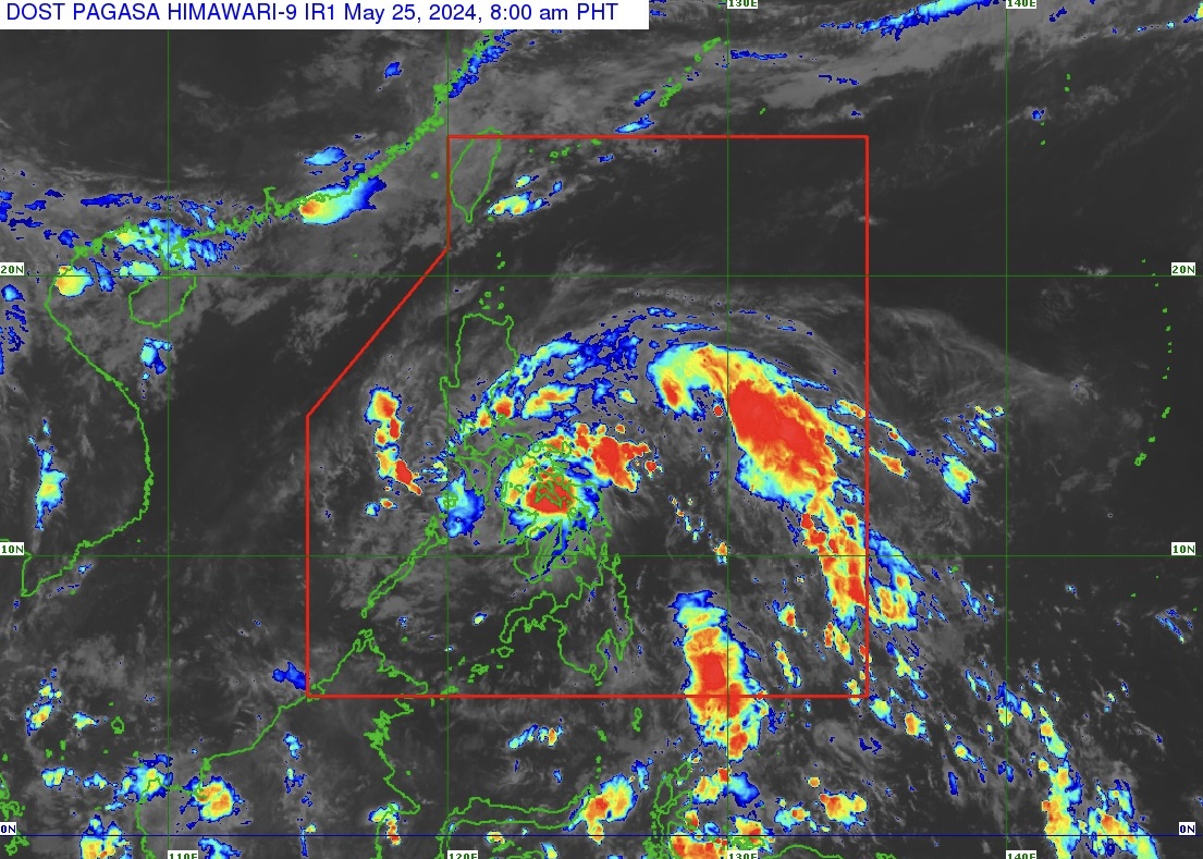
Tropical Depression “Aghon” (TD Aghon) continues to move northwestward at 30 kilometers per hour (km/h) and is now over the Samar sea, based on Tropical Cyclone Bulletin Number 9 issued by PAGASA at 8 a.m. on May 25, 2024.
The center of TD Aghon was estimated based on all available data over the coastal waters of Calbayog City, Samar packing maximum sustained winds of 55 km/h near the center and gustiness of up to 85 km/h.
TROPICAL CYCLONE WIND SIGNALS (TCWS) IN EFFECT
TCWS Signal Number 1 (strong winds) is raised over:
Luzon
Aurora, Polillo Islands, the northern and southeastern portion of Quezon (Calauag, Guinayangan, Lopez, Buenavista, Catanauan, Mulanay, San Narciso, San Francisco, San Andres, Tagkawayan, Gumaca, Quezon, Alabat, Perez, Plaridel, Pitogo, Macalelon, General Luna, Atimonan, Unisan, Mauban, Real, Infanta, General Nakar, Padre Burgos, Agdangan), the eastern portion of Romblon (Cajidiocan, Magdiwang, San Fernando, Romblon), the eastern portion of Marinduque (Santa Cruz, Torrijos), Camarines Norte, Camarines Sur, Catanduanes, Albay, Sorsogon, and Masbate including Burias and Ticao Islands;
Visayas
Northern Samar, Samar, Eastern Samar, Biliran, the northern portion of Leyte (Tunga, Pastrana, San Miguel, Matag-Ob, Tolosa, Palo, Calubian, Leyte, Mayorga, Julita, Carigara, Babatngon, Dagami, Jaro, San Isidro, Santa Fe, Albuera, Villaba, La Paz, Palompon, Tabontabon, Tanauan, Merida, Ormoc City, Isabel, Dulag, Capoocan, Alangalang, Burauen, Tabango, Tacloban City, Kananga, Barugo), and the extreme northern portion of Cebu (San Remigio, Tabogon, City of Bogo, Medellin, Daanbantayan, Borbon) including Camotes and Bantayan Islands.
HEAVY RAINFALL OUTLOOK
Forecast accumulated rainfall: May 25, 2024
• 100-200 mm: Bicol Region, Northern Samar, and the northern portion of Samar
• 50-100 mm: The southern portion of Quezon, Polillo Islands, Marinduque, the eastern portion of Romblon, the rest of Samar, Eastern Samar, Biliran, and the northern portions of Western Visayas, Leyte, and Cebu
Forecast accumulated rainfall: May 26, 2024
• 100-200 mm: Camarines Norte, Camarines Sur, and Catanduanes.
• 50-100 mm: Quezon, Aurora, and the rest of Bicol Region
Forecast rainfall are generally higher in elevated or mountainous areas.
SEVERE WINDS
The wind signals warn the public of the general wind threat over an area due to the tropical cyclone. Local winds may be slightly stronger/enhanced in coastal and upland/mountainous areas exposed to winds. Winds are less strong in areas sheltered from the prevailing wind direction.
• Minimal to minor impacts from strong winds are possible within any of the areas under Wind Signal No. 1.
HAZARDS AFFECTING COASTAL WATERS
TD Aghon will bring moderate to rough seas (1.5 to 3.5 m) over the coastal waters along the seaboards of Bicol Region, the southern seaboard of Quezon, the eastern seaboard of Eastern Visayas, the western seaboard of Samar and Northern Samar, and the eastern seaboard of Caraga Region. Mariners of motor bancas and similarly-sized vessels are advised to take precautionary measures while venturing out to sea and, if possible, avoid navigating in these conditions, especially if inexperienced or operating ill-equipped vessels.
The next tropical cyclone bulletin will be issued at 11 a.m. today, May 25, 2024.
