


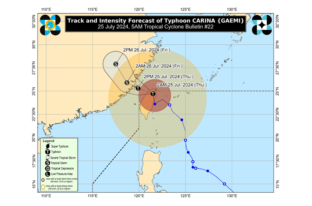
#CarinaPH is now crossing Taiwan and exited the Philippine Area of Responsibility (PAR) today, July 25, 2024, according to the Department of Science and Technology - Philippine Atmospheric, Geophysical and Astronomical Services Administration (DOST-PAGASA).
Meanwhile, the enhanced Southwest Monsoon continues to affect various parts of Luzon with heavy rains and strong winds.
The center of #CarinaPH was last located 465 km north of Itbayat, Batanes, moving northward at 20 km/h. The typhoon has maximum sustained winds of 150 km/h near the center and gusts of up to 185 km/h.
TROPICAL CYCLONE WIND SIGNALS (TCWS)
TCWS No. 1: Batanes. Minimal to minor impacts from strong winds are anticipated.
PAGASA advised residents to inspect their homes for necessary repairs, clean drainage systems, harvest crops that can be yielded, and monitor PAGASA’s severe weather bulletins.
RAINFALL FORECAST
While Typhoon Carina is less likely to bring heavy rainfall directly over the country, the enhanced Southwest Monsoon will result in moderate to intense rainfall over the western portion of Luzon until July 27.
The affected areas include the Ilocos Region, Cordillera Administrative Region, Nueva Vizcaya, Quirino, Isabela, Central Luzon, Metro Manila, CALABARZON, MIMAROPA, Bicol Region, Western Visayas, Negros Occidental, and Northern Samar.
GALE WARNING
Gale warnings are in effect over the coastal waters of Batanes, Babuyan Islands, Ilocos Norte, Ilocos Sur, and northwestern Cagayan.
Sea travel is risky for small seacrafts, and mariners are advised to take precautionary measures or avoid navigation under these conditions.
#CarinaPH is expected to cross the Taiwan Strait, and make its final landfall over southeastern China by evening of July 25.
The typhoon will weaken as it interacts with Taiwan’s mountainous terrain and southeastern China’s landmass.
