


Tropical Storm #NikaPH has weakened and exited the Philippine Area of Responsibility (PAR), according to the Philippine Atmospheric, Geophysical, and Astronomical Services Administration (PAGASA).
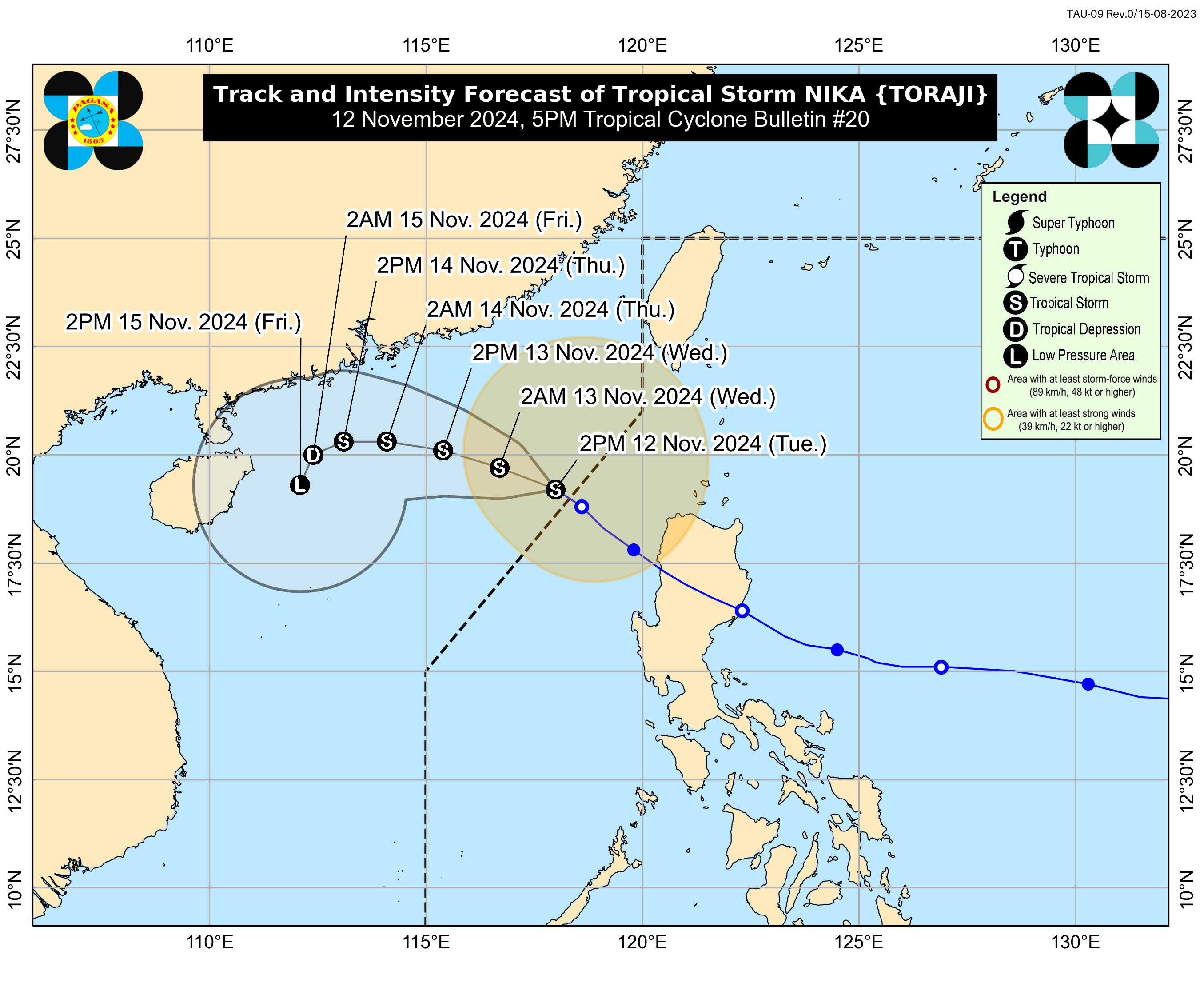
As of 5:00 p.m. on November 12, 2024, the center of #NikaPH was located 365 km west of Calayan, Cagayan, outside of PAR.
The storm is moving northwestward at a speed of 15 km/h.
#NikaPH currently has maximum sustained winds of 85 km/h near its center, with gustiness reaching up to 105 km/h.
No Tropical Cyclone Wind Signal has been raised as of the latest advisory.
Hazards Affecting Land Areas:
Heavy Rainfall:
- Tropical Storm NIKA is not expected to bring heavy rainfall over the country within the next three days.
Severe Winds:
- The channeling of winds from the Luzon Strait due to #NikaPH will bring strong to gale-force gusts over the following areas, especially in coastal and upland regions:
- Batanes and Babuyan Islands (today, November 12)
Coastal Inundation:
- #NikaPH no longer poses any threat of storm surge inundation in the coastal areas of the country.
24-Hour Sea Condition Outlook:
- Rough seas up to 3.0 meters over:
- The western seaboard of Batanes and Babuyan Islands
- The seaboard of Ilocos Norte
Mariners of small seacrafts, including all types of motorbancas, are advised not to venture out to sea under these conditions, especially if inexperienced or operating ill-equipped vessels.
- Moderate seas up to 2.5 meters over:
- The remaining seaboards of Batanes, Babuyan Islands, and Ilocos Region
- The northern seaboard of mainland Cagayan, and the northern and eastern seaboards of Catanduanes
- Moderate seas up to 2.0 meters over:
- The remaining seaboard of Cagayan Valley
- The western seaboard of Zambales
- The seaboards of northern Aurora and Kalayaan Islands
- The northern and eastern seaboards of Camarines Sur and Northern Samar
- The eastern seaboards of Albay, Sorsogon, and Eastern Samar
Mariners of motorbancas and similarly-sized vessels are advised to take precautionary measures while venturing out to sea and, if possible, avoid navigation under these conditions.
Track and Intensity Outlook:
#NikaPH is forecast to continue moving generally west northwestward to westward over the West Philippine Sea. It is expected to shift to a southwestward direction starting Thursday. Due to increasingly unfavorable environmental conditions, #NikaPH may weaken into a tropical depression by Thursday evening or Friday early morning and could degenerate into a remnant low by Friday afternoon or evening.
