


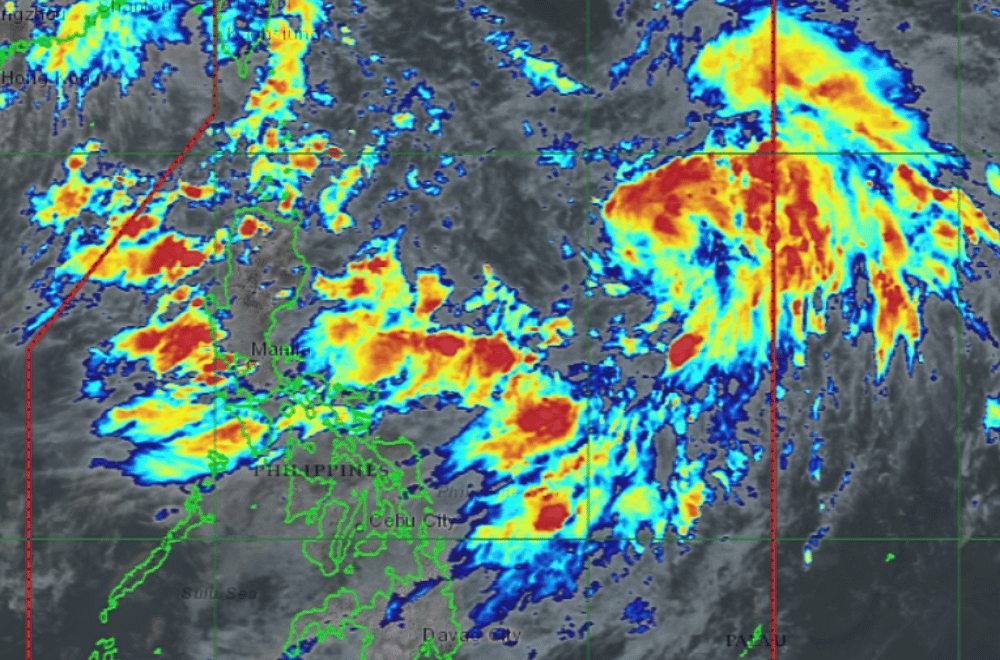
A Low Pressure Area (LPA) east of Aurora developed into a tropical depression at 2 p.m. Tuesday, July 22, 2025, and was named #DantePH, according to the Philippine Atmospheric, Geophysical and Astronomical Services Administration (PAGASA).
PAGASA continues to warn the public about heavy rainfall brought by the enhanced Southwest Monsoon, or habagat, especially in Luzon and parts of the Visayas.
From today until noon of Wednesday, July 23, rainfall may exceed:
200 mm in: Zambales, Bataan, Metro Manila, Cavite, Batangas, and Occidental Mindoro
100–200 mm in: Pangasinan, Benguet, Tarlac, Pampanga, Bulacan, Laguna, and Rizal
50–100 mm in: Ilocos Region, Quezon, Mimaropa, Bicol Region, and parts of Western Visayas including Antique, Iloilo, Guimaras, and Negros Occidental
From Wednesday noon to Thursday noon (July 24), rainfall could again exceed:
200 mm in: Pangasinan, Zambales, and Bataan
100–200 mm in: La Union, Benguet, Pampanga, Bulacan, Metro Manila, Cavite, Batangas, Laguna, Rizal, and Occidental Mindoro
50–100 mm in: Northern Luzon provinces, Quezon, Mimaropa, Bicol Region, and Antique
From Thursday noon to Friday noon (July 25):
100–200 mm in: Ilocos Norte, Ilocos Sur, La Union, Pangasinan, Zambales, and Bataan
50–100 mm in: Cordillera Region, Central Luzon, Metro Manila, CALABARZON, Mimaropa, and Antique
Rainfall may be heavier in mountainous areas, and flooding or landslides are more likely in areas that have already received a lot of rain over the past days.
PAGASA advises all residents and local officials to stay alert and take precautions to protect life and property. Local PAGASA offices may issue more specific Heavy Rainfall Warnings or Thunderstorm Advisories as needed.
