


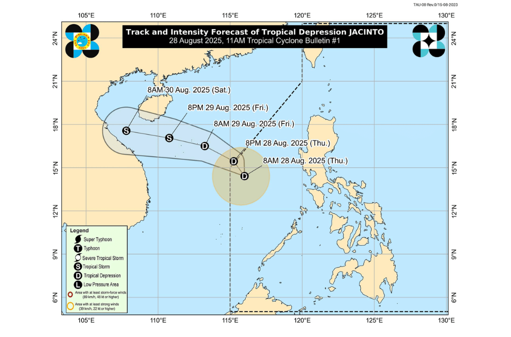
A low pressure area over the West Philippine Sea has developed into Tropical Depression #JacintoPH, the state weather bureau said morning on Thursday, August 28, 2025.
As of 10 a.m., the weather system was located 480 kilometers west of Subic Bay, carrying maximum sustained winds of 45 kilometers per hour near the center and gusts of up to 55 kph. It was moving west northwest at 20 kph.
No tropical cyclone wind signal has been raised.
PAGASA said Jacinto will move northwest and is expected to leave the Philippine Area of Responsibility (PAR) tonight. After exiting, it will head toward northern or central Vietnam, where it could make landfall on Saturday, August 30. The cyclone may strengthen into a tropical storm by Friday evening.
Although Jacinto is far from land, it is enhancing the southwest monsoon, which will bring strong winds and occasional heavy rain over parts of Northern and Central Luzon, MIMAROPA, Visayas, and some northern Mindanao provinces.
Sea conditions will also be rough, especially along the western and northern seaboards of Palawan, Calamian Islands, Batanes, Babuyan Islands, and Zambales, with waves reaching up to 3.5 meters. PAGASA advised operators of small boats and motorbancas not to sail in these areas.
The public and local disaster offices were urged to stay alert for possible floods, landslides, and coastal hazards, and to follow instructions from local officials.
Unless significant changes occur, PAGASA will issue its next bulletin at 5 p.m. Thursday.
