


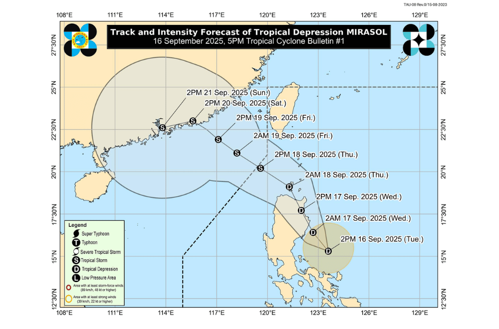
A low pressure area east of Quezon has developed into Tropical Depression #MirasolPH, the Philippine Atmospheric, Geophysical and Astronomical Services Administration (PAGASA) announced afternoon on Tuesday, September 16, 2025.
As of 4 p.m., Mirasol was located 210 kilometers east northeast of Infanta, Quezon. It was moving northwest at 25 kilometers per hour, carrying maximum sustained winds of 55 kph and gusts of up to 70 kph.
Tropical Cyclone Wind Signal No. 1 was raised over:
- Batanes
- Cagayan including Babuyan Islands
- Isabela
- Quirino
- Northeastern portion of Nueva Vizcaya (Diadi, Quezon, Kasibu, Dupax del Norte, Bambang, Ambaguio, Bayombong, Solano, Villaverde, Bagabag)
- Northern and central portions of Aurora (Dilasag, Casiguran, Dinalungan, Dipaculao, Baler)
- Apayao
- Kalinga
- Abra
- Mountain Province
- Ifugao
- Ilocos Norte
- Polillo Islands
- Northern portion of Camarines Norte (Vinzons, Capalonga, Jose Panganiban, Paracale, Talisay, Daet, Mercedes)
- Northeastern portion of Camarines Sur (Caramoan, Garchitorena, Presentacion, Lagonoy, Siruma, Tinambac, Goa, San Jose)
- Catanduanes
PAGASA said Mirasol may make landfall in Isabela or northern Aurora by morning on Wednesday, September 17. However, if it shifts more northward, it could instead stay along the coastal waters of Northern and Central Luzon without making landfall.
By Thursday, September 18, Mirasol is expected to move into the Luzon Strait and exit the Philippine Area of Responsibility (PAR). It may then strengthen into a tropical storm once it reaches the West Philippine Sea.
The enhanced southwest monsoon is also expected to bring strong to gale-force gusts over parts of Quezon, Bicol, MIMAROPA, Panay Island, and portions of Northern Luzon in the next two days.
Sea travel may be risky, with moderate seas of up to 2.5 meters forecast over the coastal waters of Batanes, Babuyan Islands, Cagayan, Isabela, Aurora, and Ilocos Norte.
PAGASA advised small boats and motorbancas to take extra caution or avoid sailing.
