


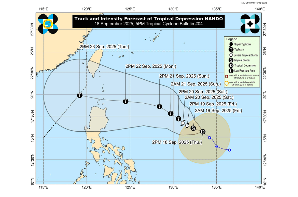
Tropical Depression #NandoPH picked up speed on Thursday, September 18, 2025, as it moved northwest over the Philippine Sea, PAGASA warned it could strengthen into a typhoon.
As of 4 p.m., Nando was spotted 1,260 kilometers east of Central Luzon, carrying maximum sustained winds of 55 kilometers per hour and gusts of up to 70 kph. It was moving northwest at 15 kph, with strong winds stretching as far as 380 kilometers from its center.
No wind signals have been raised yet, but PAGASA said Signal No. 1 may be issued over Northern Luzon as early as Saturday, September 20.
Depending on its strength, higher wind signals could follow, possibly reaching Signal No. 5 if Nando develops into a super typhoon.
PAGASA said Nando is not expected to directly affect the country’s weather in the next two days, but it may enhance the southwest monsoon by Sunday, September 21, or Monday, September 22, bringing heavy rains and strong winds to parts of Luzon.
By Saturday or Sunday, Nando may move closer to Extreme Northern Luzon, possibly passing near or making landfall over the Babuyan Islands. It is forecast to intensify into a typhoon over the sea, with the chance of further strengthening as it approaches land.
Sea conditions are expected to worsen by the weekend, with waves possibly reaching up to 14 meters near Extreme Northern Luzon. Mariners of small boats are advised to take precaution.
