


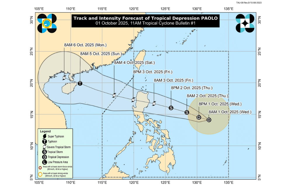
A new tropical depression named #PaoloPH has formed east of Southern Luzon, PAGASA reported on Wednesday, October 1, 2025.
While it is not expected to immediately affect the country, it could bring heavy rains and strong winds to parts of Northern and Central Luzon by Friday, October 3.
At 7 a.m., Paolo was located 760 kilometers east of Virac, Catanduanes, packing maximum sustained winds of 45 kilometers per hour and gusts of up to 55 km/h. The system is moving westward at 25 km/h, and its strong winds extend up to 360 km from its center.
No tropical cyclone wind signals have been issued yet, but PAGASA warned that Wind Signal No. 1 may be raised later today over eastern Northern and Central Luzon.
The storm could intensify into a severe tropical storm by Friday, with a possibility of reaching typhoon strength before making landfall in Isabela or northern Aurora.
Heavy rains are likely in Northern and Central Luzon starting Friday, with potential flooding in low-lying areas.
Moderate to rough seas may affect northern and central seaboards starting Friday morning. Gale warnings could be issued by Thursday afternoon.
Strong gusts may affect exposed coastal and upland areas. Worst-case scenario could reach Wind Signal No. 4 if Paolo strengthens into a typhoon.
Authorities urged residents in vulnerable areas to monitor updates, follow local evacuation orders, and prepare for possible flooding and rough sea conditions.
