


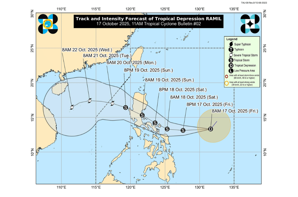
Tropical Depression #RamilPH slightly intensified morning on Friday, October 17, 2025, while moving over the Philippine Sea toward the Bicol region, according to PAGASA.
At 10 a.m., the center of Ramil was located about 760 kilometers east of Virac, Catanduanes. It had maximum sustained winds of 55 kilometers per hour and gusts of up to 70 km/h while moving southwest at 25 km/h.
Areas under Signal No. 1 (strong winds, 39–61 km/h)
- Eastern and southern portions of Quezon (Tagkawayan, Perez, Alabat, Quezon, Atimonan, Padre Burgos, Unisan, Gumaca, Plaridel, Agdangan, Pagbilao, Mauban, Calauag, Guinayangan, Lopez, Pitogo, Macalelon, General Luna, Catanauan, San Narciso, Buenavista, San Francisco, San Andres, Mulanay) including Pollilo Islands
- Camarines Norte
- Camarines Sur
- Catanduanes
- Albay
- Sorsogon
- Burias Island
- Ticao Island
- Northern Samar
- Northern portion of Eastern Samar (San Policarpo, Arteche, Oras, Dolores, Maslog, Jipapad, Taft, Can-Avid)
- Northern portion of Samar (Matuguinao, San Jose de Buan, Calbayog City, Gandara, Santa Margarita, Pagsanghan, San Jorge)
PAGASA said minimal to minor damage from strong winds is possible in these areas. However, Ramil may intensify into a tropical storm within 12 hours and possibly become a severe tropical storm before landfall, which could raise stronger wind signals.
Ramil is expected to move westward and may make landfall over Catanduanes by afternoon on Saturday, October 18.
It could later cross Aurora or Quezon by morning on Sunday, October 19, before moving toward the West Philippine Sea, where it might strengthen further before leaving the Philippine Area of Responsibility by Monday, October 20.
The weather bureau warned of possible storm surges reaching one to two meters in coastal areas of Cagayan, Isabela, Aurora, Quezon, Bicol, and Northern Samar. Rough to very rough seas are also expected along the eastern coast of Southern Luzon and Eastern Visayas, where small boats are advised not to sail.
Residents in flood-prone and coastal areas are urged to stay alert and follow evacuation orders from local officials as heavy rains, strong winds, and storm surges are expected even in areas outside the storm’s direct path.
