


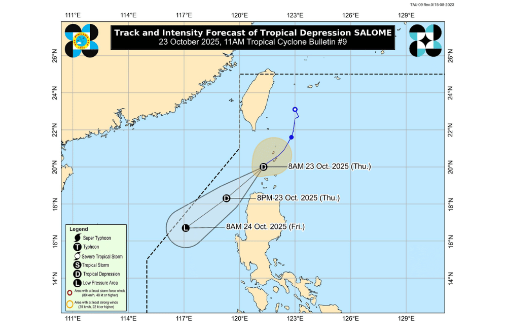
#SalomePH weakened into a Tropical Depression as it moved southwest over the Balintang Channel morning on Thursday, October 23, 2025, according to PAGASA.
As of 10 a.m., PAGASA said the center of Salome was located about 115 kilometers northwest of Calayan, Cagayan. It had maximum sustained winds of 45 kilometers per hour, gusts of up to 55 km/h, and was moving southwest at 20 km/h.
PAGASA said Salome may pass close to Ilocos Norte later today before continuing its southwestward track. The storm is expected to weaken further and may dissipate into a low-pressure area within the next day or two.
Areas under Tropical Cyclone Wind Signal No. 1 (strong winds, 39–61 km/h)
- Batanes
- Northern and western portions of Babuyan Islands (Calayan Is., Dalupiri Is., Babuyan Is.)
- Northwestern portion of Ilocos Norte (Bangui, Pagudpud, Burgos, Pasuquin, Bacarra, Laoag City)
Heavy rains of 50 to 100 millimeters are expected over Batanes from Thursday to Friday noon, with higher amounts possible in mountainous areas.
Even areas outside the warning signal may still experience gusty conditions due to the northeasterly windflow, especially along coastal and upland areas of Cagayan, Ilocos Norte, and Ilocos Sur. These gusts may continue in Batanes and nearby islands until Saturday.
A gale warning is in effect over the seaboard of Extreme Northern Luzon, where waves could reach up to six meters high. Sea travel is considered risky for all types of vessels across the coastal waters of Batanes, Babuyan Islands, Ilocos Norte, and nearby provinces.
