


A tropical depression outside the Philippine Area of Responsibility (PAR) is expected to enter the country’s monitoring zone on Sunday, November 2, 2025 and could intensify into a typhoon before making landfall early next week, according to PAGASA.
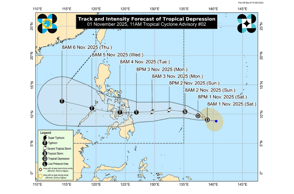
As of 10 a.m. Saturday, November 1, the tropical depression was located about 1,375 kilometers east of northeastern Mindanao.
It had maximum sustained winds of 45 kilometers per hour near the center, gusts of up to 55 km/h, and was moving west-northwest at 15 km/h.
Once it enters the PAR, the weather system will be named “Tino.”
PAGASA said it will likely move westward and may make its first landfall over the Caraga Region or Eastern Visayas between Monday evening and Tuesday morning.
After crossing the Visayas, it may pass over the northern parts of the Sulu Sea and Palawan before emerging into the West Philippine Sea by Wednesday.
The storm is expected to gradually strengthen and may reach typhoon category by Monday afternoon or evening. PAGASA also warned that rapid intensification is not ruled out, meaning the system could strengthen faster than expected before landfall.
Tropical Cyclone Wind Signal No. 1 may be raised over parts of Eastern Visayas and Caraga by Sunday once the cyclone enters the PAR. Depending on its strength, the highest wind signal that may be raised is Signal No. 4.
Heavy rains are likely to begin affecting Eastern Visayas and Caraga by Monday morning, while rough to very rough seas may be experienced over the eastern seaboards of Luzon, Visayas, and Mindanao within the next three days due to the combined effects of the tropical system and the northeast monsoon.
PAGASA said storm surge warnings may be issued as early as Sunday as coastal flooding could occur in areas along the storm’s path.
The weather bureau advised residents and local disaster offices in Visayas and Mindanao to closely monitor updates and prepare for possible heavy rains, strong winds, and rough seas in the coming days.
