


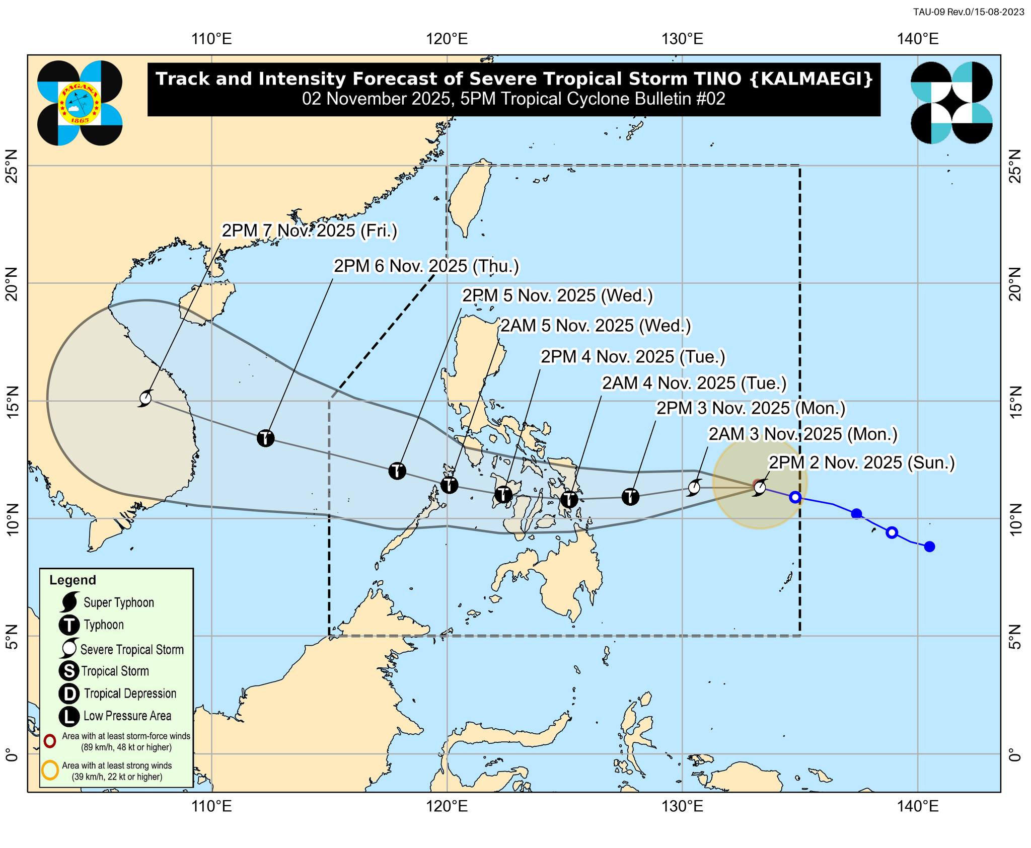
#TinoPH has intensified into a severe tropical storm while over the Philippine Sea, according to PAGASA's Tropical Cyclone Bulletin Number 2 issued at 5 p.m. on Sunday, November 2, 2025.
• Location of Center (4:00 PM)
The center of Severe Tropical Storm Tino (international name: Kalmaegi) was estimated based on all available data at 805 km East of Eastern Visayas (11.4°N, 133.1°E)
• Intensity
Maximum sustained winds of 95 km/h near the center, gustiness of up to 115 km/h, and central pressure of 990 hPa
• Present Movement
Westward at 30 km/h
• Extent of Tropical Cyclone Winds
Strong to storm-force winds extend outwards up to 240 km from the center
TROPICAL CYCLONE WIND SIGNALS (TCWS) IN EFFECT
TCWS No. 1
* Wind threat: Strong winds
* Warning lead time: 36 hours
* Range of wind speeds: 39 to 61 km/h (Beaufort 6 to 7)
* Potential impacts of winds: Minimal to minor threat to life and property
VISAYAS:
Eastern Samar, Northern Samar, Samar, Biliran, Leyte, Southern Leyte, and Camotes Islands
MINDANAO:
Dinagat Islands and Surigao del Norte
(Info courtesy: DOST-PAGASA)
