


A tropical depression has formed south of Guam and may enter the Philippine Area of Responsibility (PAR) later this week, according to PAGASA.
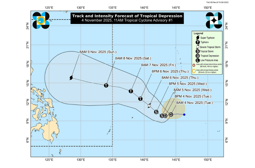
As of 10 a.m. Tuesday, the weather bureau said the tropical depression was located about 1,985 kilometers east of northeastern Mindanao.
It packed maximum sustained winds of 55 kilometers per hour near the center, gusts of up to 70 km/h, and was moving west at 20 km/h.
Once it enters the PAR, the system will be named “Uwan.”
PAGASA said the cyclone is expected to slow down in the next 24 hours as of press time, before gradually turning northwestward over the Philippine Sea. It may enter the PAR by evening on Friday, November 7 or Saturday, November 8, 2025.
While it is still too far to determine the exact track and possible landfall location, PAGASA said the chance of landfall in the Philippines is becoming more likely based on current forecasts.
The tropical depression is expected to continue strengthening over the sea and may reach typhoon category by Thursday, November 6, and possibly super typhoon strength over the weekend.
As press time, it has no direct effect on any part of the country, but PAGASA warned that rough to very rough seas may begin affecting the northern and eastern seaboards starting Saturday, November 8, due to the combined effects of the tropical system and the northeast monsoon.
PAGASA urged the public and local disaster offices to closely monitor updates as the system develops and approaches the country in the coming days.
