


Typhoon #UwanPH began pounding parts of the Bicol Region and nearby areas early Sunday, November 9, 2025, bringing life-threatening winds, heavy rain, storm surge, and flooding. Coastal towns and low-lying areas experienced rising waters as the typhoon moved toward Luzon.
In Bacacay, Albay, residents faced rough seas and strong waves at the port by 6 a.m., while heavy rain and strong winds lashed San Andres, Catanduanes, later in the morning.
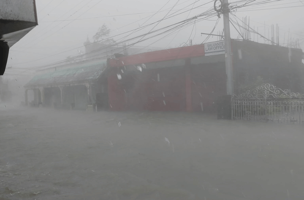
In Virac, Catanduanes, streets were flooded and trees were toppled as wind and rain intensified. Floodwaters reportedly reached waist level in some areas.
“Kasalukuyang hanggang dibdiban na po, Sir. Doon sa bandang may waiting shed is lagpas tao na po,” Mark Niño Gonzales, a resident of Barangay Gogon Centro, told GMA Regional TV News.
Coastal communities were also battered by storm surge.
Big waves inundated homes along the shore in Barangay J.M. Alberto, Baras, Catanduanes.
In Guinobatan, Albay, lahar from the Mayon Volcano that have accumulated in mountains nearby flowed into streets following heavy rainfall.
Roads such as the Amper Baywalk in Dipaculao, Aurora were rendered impassable for all types of vehicles by mid-morning.
In Calbayog, Eastern Samar, makes its presence felt with strong winds and heavy rain evening on Saturday, November 8.
According to the Philippine Atmospheric, Geophysical, and Astronomical Services Administration (PAGASA), Uwan’s eye was over the coastal waters of Pandan, Catanduanes at 11 a.m., with maximum sustained winds of 185 km/h and gusts of up to 230 km/h.
The typhoon is moving west-northwest at 30 km/h and is expected to make landfall in central Aurora evening on the same day or early Monday, November 10, while maintaining super typhoon strength.
PAGASA warned that dangerous conditions could affect areas far from the typhoon’s center, including heavy rainfall, severe winds, and storm surges.
Uwan is forecast to cross Northern Luzon before weakening over Lingayen Gulf or the coasts of Pangasinan and La Union on Monday morning, but it will remain a typhoon as it heads northwest toward Taiwan.
Residents in coastal and low-lying areas are urged to take all necessary precautions, follow evacuation orders, and monitor updates from local authorities.
