


Signal No. 1 has been raised over 16 areas nationwide as Tropical Storm Ada maintains strength over Eastern Visayas, according to a GMA News Online report.
According to PAGASA’s cyclone bulletin on Friday afternoon, January 16, 2026, the following areas under Signal no. 1 will have winds of 39 to 61 kph or intermittent rains for at least 36 hours:
The southern portion of Quezon (San Narciso, Mulanay, San Francisco, San Andres, Buenavista, Catanauan, Lopez, Calauag, Guinayangan, Tagkawayan)
Camarines Norte
Camarines Sur
Catanduanes
Albay
Sorsogon
Masbate
Northern Samar
Samar
Eastern Samar
Biliran
Leyte
Southern Leyte
The northern portion of Cebu (Medellin, Daanbantayan, San Remigio, City of Bogo, Tabogon) including Camotes Islands and Bantayan Islands
Dinagat Islands
Siargao - Bucas Grande Islands
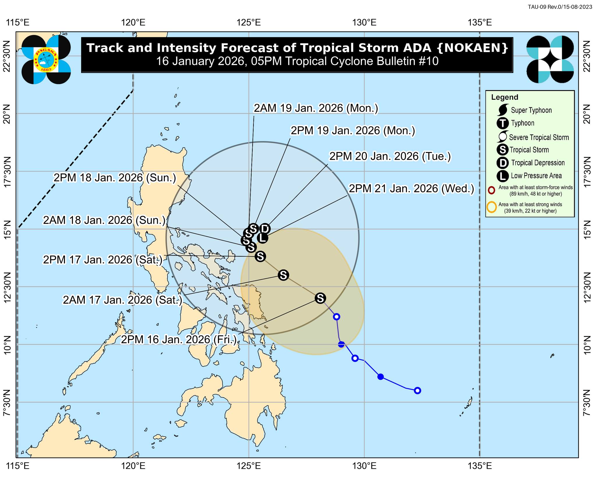
“The highest wind signal that may be hoisted throughout the passage of #AdaPH is Wind Signal No. 2,” PAGASA said in its advisory.
As of 4 p.m., the center of #AdaPH was estimated based on all available data at 255 km East Northeast of Borongan City, Eastern Samar or 335 km East of Catarman, Northern Samar (12.3°N, 127.7°E).
Meanwhile, the state weather bureau said that heavy rainfall and severe winds may be experienced in areas outside the landfall point and forecast confidence cone.
Ada is predicted to pass closer to Eastern Samar and Northern Samar on Saturday, January 17, before moving slowly or remaining stationary over Catanduanes by Sunday, January 18, onwards.
A landfall scenario is possible over Eastern Visayas and Bicol Region due to a potential change in the forecast track.
#AdaPH may remain a tropical storm over the east of Visayas and Southern Luzon before weakening into a tropical depression by Tuesday, January 20, and downgrading into a remnant low by Wednesday, January 21.
