


Several areas in Surigao provinces have been placed under Tropical Cyclone Wind Signal No.1 due to Tropical Depression #BasyangPH.
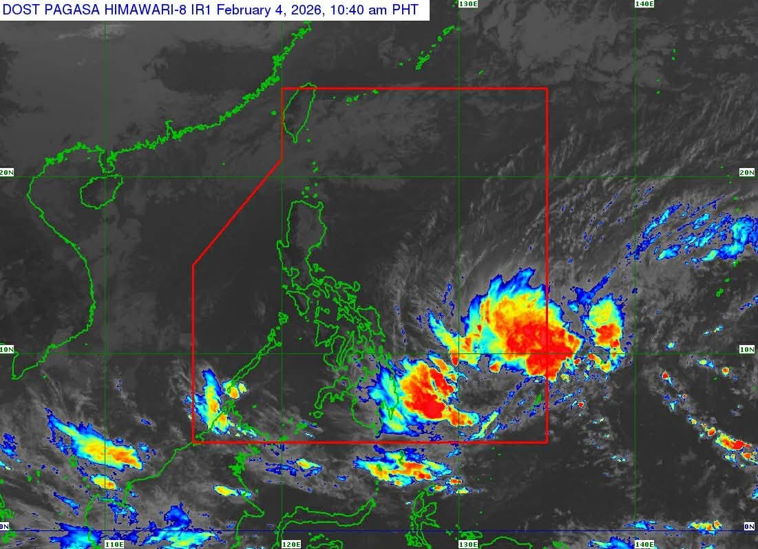
In its advisory issued at 11 a.m. on Wednesday, February 4, 2026, state weather bureau PAGASA said the #BasyangPH has maintained its strength as it moves southwestward over the east of Mindanao.
PAGASA said the center of #BasyangPH was estimated at 735 kilometers east of Hinatuan, Surigao del Sur, as of 10 a.m.
It has a maximum sustained winds of 55 km/h near the center and gustiness of up to 70 km/h.
The Province of Surigao del Sur and eastern portion of Surigao del Norte (Claver, Gigaquit, Bacuag), including Siargao and Bucas Grande Islands are placed under TCWS No.1.
PAGASA added that the surge of the Northeast Monsoon will also bring strong to gale-force gusts in the following areas:
• Today: Most of Luzon, Visayas, Dinagat Islands, Caraga, Davao Region, Zamboanga Peninsula, Camiguin, Misamis Oriental, and Lanao del Norte.
• Tomorrow (05 February): Most of Luzon, Visayas, Caraga, Davao Region, Northern Mindanao, Zamboanga Peninsula, Basilan, and Tawi-Tawi.
• Friday (06 February): Batanes, Babuyan Islands, northern portion of mainland Cagayan, Ilocos Norte, Central Luzon, Metro Manila, CALABARZON, MIMAROPA, Bicol Region, Visayas, and most of Mindanao.
PAGASA said #BasyangPH will move generally westward in the next 36 hours before turning west northwestward starting Thursday evening, February 5, 2026.
The state weather bureau added that #BasyangPH is expected to make its initial landfall over eastern Mindanao between Thursday evening and Friday morning, February 6, 2026.
It will then traverse the landmass of northeastern Mindanao and Central and Western Visayas and emerge over Sulu Sea by Saturday, February 7.
#BasyangPH is forecast to gradually intensify while over the Philippine Sea and may reach tropical storm category today.
After its initial landfall, #BasyangPH is expected to weaken into tropical depression again while traversing the Visayas and will be downgraded to low pressure area by Sunday, February 8.
