


Signal No. 2 has been raised over several areas in Mindanao as Tropical Storm #BasyangPH accelerates and moves closer toward eastern Mindanao, with an initial landfall likely over Surigao del Sur evening on Thursday, February 5, 2026.
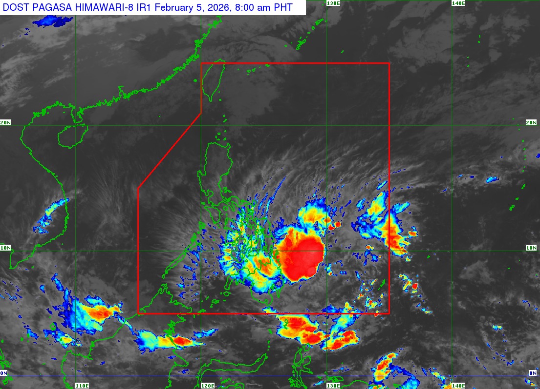
In its advisory issued at 8 a.m. on Thursday, state weather bureau PAGASA said the center of #BasyangPH was estimated at 385 kilometers east of Hinatuan, Surigao del Sur.
It has a maximum sustained winds of 65 km/h near the center and gustiness of up to 80 km/h.
Signal No. 2 is hoisted over the following areas:
MINDANAO
- Surigao del Norte including Siargao - Bucas Grande Islands,
- Surigao del Sur,
- Extreme northern portion of Davao Oriental (Boston)
- Agusan del Norte
- Agusan del Sur
- Misamis Oriental
- Northern portion of Bukidnon (Impasug-Ong, Manolo Fortich, Malitbog, Sumilao, Libona, Baungon, City of Malaybalay, Cabanglasan)
- Northeastern portion of Lanao del Norte (Iligan City)
- Northeastern portion of Misamis Occidental (Baliangao, Plaridel, Lopez Jaena, Oroquieta City, Calamba, Aloran, Panaon)
- Camiguin
Signal No. 1 is raised over the following areas:
LUZON
- Cuyo Islands
VISAYAS
- Southern portion of Eastern Samar (Guiuan, Salcedo, Mercedes, Giporlos, Balangiga, Lawaan, Quinapondan, General Macarthur, Hernani, Llorente, Balangkayan),
- Southern portion of Samar (Marabut, Basey, Santa Rita),
- Biliran, Leyte,
- Southern Leyte
- Bohol
- Cebu
- Siquijor
- Negros Oriental
- Negros Occidental
- Guimaras
- Iloilo
- Capiz
- Aklan
- Antique
MINDANAO
- Dinagat Islands
- Northern and central portions of Davao Oriental (Cateel, Baganga, Caraga, Manay, Tarragona, Lupon, Banaybanay)
- Davao de Oro
- Davao del Norte
- Northern portion of Davao del Sur (Davao City)
- The rest of Bukidnon
- Northern portion of Cotabato (Carmen, Banisilan, Alamada, President Roxas, Antipas, Arakan, Magpet, Matalam, Kabacan)
- Lanao del Sur
- Northern portion of Maguindanao del Norte (Buldon, Barira, Matanog)
- The rest of Lanao del Norte
- The rest of Misamis Occidental
- Eastern and central portions of Zamboanga del Norte (Mutia, Piñan, Polanco, Dipolog City, Dapitan City, Sibutad, Rizal, La Libertad, Labason, Kalawit, Liloy, Salug, Bacungan, Sindangan, Jose Dalman, Manukan, Pres. Manuel A. Roxas, Katipunan, Sergio Osmeña Sr., Siayan, Godod, Tampilisan, Gutalac)
- Northern and central portions of Zamboanga del Sur (Bayog, Kumalarang, Lapuyan, San Miguel, Guipos, Dinas, San Pablo, Dumalinao, Pagadian City, Tigbao, Lakewood, Dumingag, Mahayag, Molave, Josefina, Tambulig, Aurora, Ramon Magsaysay, Sominot, Midsalip, Labangan, Tukuran)
- Northern portion of Zamboanga Sibugay (Kabasalan, Diplahan, Naga, Titay, Ipil, Buug)
PAGASA said #BasyangPH is momentarily moving west southwestward, and will move generally westward until evening on Thursday before turning west northwestward beginning tomorrow morning, February 6.
The state weather bureau added that #BasyangPH is expected to make its initial landfall over Surigao del Sur between Thursday evening and Friday morning, February 6, 2026.
After crossing Mindanao, #BasyangPH is likely to emerge over Bohol Sea morning on Friday, February 6, and may pass close to make another landfall over Siquijor and the southern portion of Negros Oriental by Friday afternoon.
PAGASA said #BasyangPH may further intensify prior to its initial landfall. It will then slightly weaken as it interacts with the landmass, but it will likely remain a tropical storm.
It may weaken into a tropical depression by Saturday and will be downgraded into a low pressure area by Monday, February 9.
