


Following the massive magnitude 7.8 earthquake in Sarangani on June 8, 2026, the Office of Civil Defense in Negros Island Region is keeping a close eye on 10 active fault lines in the region.
These active fault lines are the following:
- Southern Negros Fault
- Manjuyod-Pamplona Fault (East Negros Fault System)
- Bindoy-Guihulngan Fault (East Negros Fault System)
- Pinocawan River Fault (East Negros Fault System)
- San Carlos Fault (East Negros Fault System)
- Calatrava-Toboso Fault (East Negros Fault System)
- Sibulan Fault
- Central Negros Fault
- Candoni Fault
- West Negros Fault
Bryll Larry Sañor, Deputy Chief of the Provincial Disaster Risk Reduction and Management Office Operations Center, said the faults can generate a magnitude of up to 6.9.
“Nandyan sa 6.9 magnitude ang pwedeng (maramdaman). Mayroon rito sa San Carlos City, Toboso, Central Negros Fault, Himaymaylan, Binalbagan, La Carlota, La Castellana (at) mga Central Negros and south naton na LGUs,” he said.
Donato Sermeno III, Regional Director of OCD-NIR said there is also the possibility of movement at the Negros Trench.
“As well as ang Negros Trench na mino-monitor. There is a possibility na gumalaw sya,” Sermeno said.
As part of preparedness efforts, PDRRMO is giving particular attention to simulations at schools and neighborhoods.
When the earthquake in Sarangani struck, thousands of students and teachers were already in school for the opening of classes.
One can say the flag ceremony saved many lives because the students and teachers were in open spaces at exactly the same time the quake hit.
SARANGANI QUAKE
In the earthquake in Sarangani, up to Intensity VII was felt by residents in General Santos City where structures were damaged or destroyed.
Based on PHIVOLCS’ intensity scale, Intensity VII is classified as ‘destructive’ with this description:
“Most people are frightened and run outdoors. People find it difficult to stand in upper floors. Heavy objects and furniture overturn or topple. Big church bells may ring. Old or poorly-built structures suffer considerable damage. Some well-built structures are slightly damaged. Some cracks may appear on dikes, fish ponds, road surface, or concrete hollow block walls. Limited liquefaction, lateral spreading and landslides are observed. Trees are shaken strongly. (Liquefaction is a process by which loose saturated sand lose strength during an earthquake and behave like liquid).”
At least 38 people died and at least 478 were injured in the Sarangani quake, as of the latest count of OCD evening on Tuesday, November 9, 2026.
At least 1,000 aftershocks were recorded.
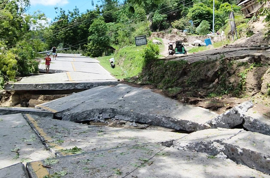
The earthquake damaged roads and bridges in Maasim, Sarangani and left a trail of destruction in Davao Occidental.
CAUSE
According to PHIVOLCS, the quake in Sarangani was caused by movement along the Cotabato Trench.
It had a depth of 33 kilometers and the epicenter was traced 32 kilometers west of Maasim, Sarangani.
PHIVOLCS said the quake’s location, focal mechanism, and aftershock pattern point to subduction along the Cotabato Trench, which is a major earthquake-generating structure off the coast of Mindanao.
Sarangani faces the Cotabato Trench.
Sarangani and the provinces nearby sit near a seismically active area.
(With reports from GMA Regional TV One Western Visayas)
