






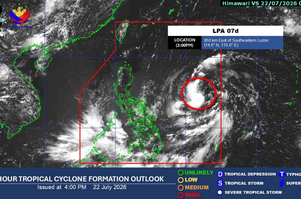
A low pressure area (LPA) inside the Philippine Area of Responsibility (PAR) has a high chance of developing into a tropical depression within the next 24 hours,
As of 2 p.m. Tuesday, PAGASA said the LPA was being monitored inside PAR and could intensify into a tropical depression within a day.
The weather bureau said the southwest monsoon, enhanced by the LPA, is expected to bring 50 to 100 millimeters of rain over parts of Zamboanga Peninsula, Northern Mindanao, Bangsamoro, Sultan Kudarat, and Sarangani through Wednesday. Similar rainfall is also forecast over parts of Western Visayas, Negros Island, and Mindanao through Friday.
Meanwhile, the LPA is expected to bring moderate to heavy rain over Cagayan from Wednesday afternoon to Friday afternoon.
From Friday afternoon to Saturday afternoon, PAGASA forecast heavy to intense rainfall of 100 to 200 millimeters over Cagayan, Apayao, Abra, Ilocos Norte, and Ilocos Sur. Batanes, Isabela, Kalinga, Mountain Province, Ifugao, Benguet, and La Union may receive 50 to 100 millimeters of rain during the same period.
PAGASA warned that rainfall could be higher in mountainous areas and that flooding and rain-induced landslides may worsen in places that have already experienced significant rainfall.
The weather bureau advised local disaster risk reduction and management offices to take the necessary measures to protect lives and property, while urging the public to continue monitoring official weather updates.