

 GMA Brandtalk
 Tracking
 Archives

FLOOD ALERT: Flooded roads in Metro Manila on Saturday, August 29, 2026
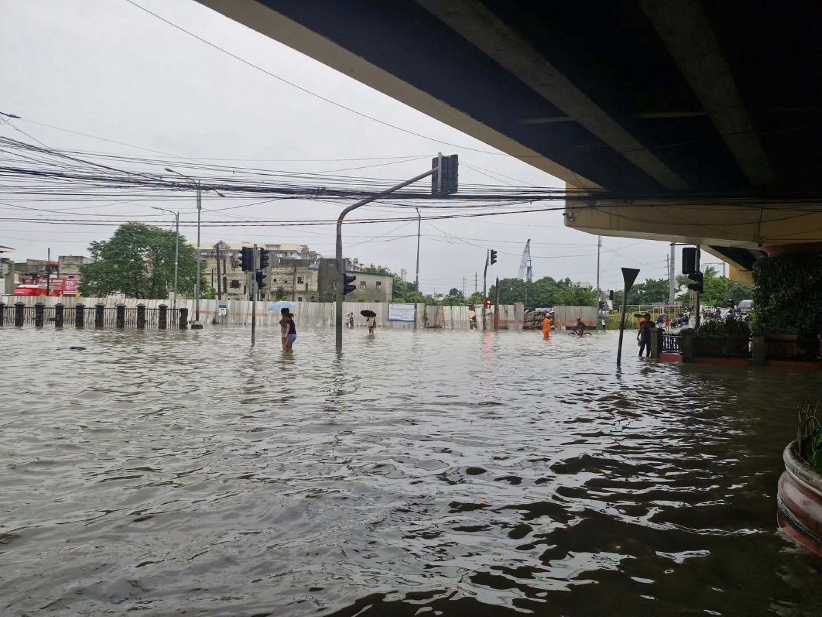
Several areas in Metro Manila were flooded on Saturday, August 29, 2026, due to heavy rains brought by the Southwest Monsoon (Habagat).
MMDA
Below are the areas flooded, according to the Metropolitan Manila Development Authority (MMDA) as of 3 p.m.
EDSA
Southbound
- Aurora Boulevard–Cubao — moderate traffic due to vehicle volume
- Shaw Crossing — moderate traffic
- Guadalupe to Buendia — moderate to slow-moving
- Tramo to Taft — moderate to slow-moving
Northbound
- FB Harrison to Taft Avenue — moderate to slow-moving
- Ayala to Buendia — moderate to slow-moving
- Pioneer to Guadix — moderate to slow-moving
- Santolan to Aurora Boulevard–Cubao — moderate to slow-moving
- New York — moderate traffic
- Seminary Road to Balintawak — slow-moving toward NLEX
C5
Southbound
- Aurora Boulevard–Katipunan service road — moderate to slow-moving
- Ortigas to Lanuza — moderate traffic
- Bagong Ilog — moderate traffic
Northbound
- Eagle Avenue to Calle Industria — moderate to slow-moving
- Eastwood to Libis — slow-moving due to vehicle volume and a damaged expansion joint at Libis Flyover
- Ateneo — moderate to slow-moving
- UP Town Center — moderate traffic
Commonwealth Avenue
Eastbound
- FCM Regalado — moderate traffic
- Labayani to Mindanao Extension — moderate to slow-moving
Westbound
- FCM Regalado — moderate traffic
Quezon Avenue
Eastbound
- Maxima — moderate to slow-moving
Westbound
- West Avenue — moderate to slow-moving
- Araneta — moderate to slow-moving
Marcos Highway
- Eastbound: Light traffic
- Westbound: Light traffic
Ortigas Avenue
Eastbound
- Greenhills — moderate to slow-moving
Westbound
- Meralco to EDSA — moderate to slow-moving
- La Salle to Greenhills — moderate to slow-moving
Roxas Boulevard
Southbound
- P. Ocampo — moderate to slow-moving
Northbound
- Arnaiz to Buendia — moderate to slow-moving
- UN Avenue — moderate to slow-moving
LGUs
Meanwhile, local government units in Metro Manila also released lists of flooded areas in their cities.
Caloocan City (as of 2:07 p.m.)
Not passable to all types of vehicles
SOUTH CALOOCAN
• Guido 1 to Guido 4, Maypajo – Manila-Caloocan Boundary
• R. Papa – Manila-Caloocan Boundary
NORTH CALOOCAN
• Congressional Road, in front of McDonald’s
• Congressional Road, Saranay
• T. Samson Rd. – Llano Rd. Intersection
• Doña Aurora – Sampaloc Bridge
Not passable to light vehicles
SOUTH CALOOCAN
• C3 NLEX Connector
• Libis Espina
• Tanigue Street, Dagat-Dagatan
• Tugatog – Malabon-Caloocan Boundary
• Letre, C4
NORTH CALOOCAN
• Camarin Road near CCNMC
• Cielito Zabarte Road
• Gen. Luis Boundary – Valenzuela Bionic
• Camarin Road cor. Rainbow, Villa Magdalena
• Crispulo Street, Sanana Market
Valenzuela City (as of 2:55 p.m.)
MacArthur Highway — Passable to all types of vehicles
- McArthur Highway corner A. Fernando — 5–6 inches of water
- Fatima Medical Center, Fatima section, Marulas — 5–6 inches
- Karuhatan Traffic Light — 5–6 inches
- In front of Valenzuela Trade Center, Malinta — 3–4 inches
- In front of Flying V, Malinta — subsided
- In front of Max Restaurant, Dalandanan — subsided
- A. Marcelo, Dalandanan — 4–6 inches
- In front of Shell Gasoline Station, Malanday — 8 inches
- In front of Phoenix Gasoline Station, Malanday — 5–6 inches
- In front of Ace Hospital, Malanday — 5–6 inches
- In front of Meralco, Malanday — 4–5 inches
- M.H. del Pilar, Malanday — 4–5 inches
MacArthur Highway — Not passable to light vehicles
- Corner G. Lazaro, Dalandanan — 13 inches
- In front of Toyota Dalandanan — 13 inches
- In front of Wilcon Depot, Dalandanan — 13 inches
- Jollibee Dalandanan corner G. Lazaro — 13 inches
MacArthur Highway — Not passable to all types of vehicles
- In front of Jollibee BBB, Marulas — 26 inches
- Police Pad, Marulas — 26 inches
Maysan, Paso de Blas–NLEX, Bagbaguin — Passable to all types of vehicles
- In front of PLDT, Maysan Road — 11 inches
- In front of 3S Maysan — 4–5 inches
Maysan, Paso de Blas–NLEX, Bagbaguin — Not passable to light vehicles
- P. Santiago, Paso de Blas (Unioil Creek) — 13 inches
Maysan, Paso de Blas–NLEX, Bagbaguin — Not passable to all types of vehicles
- Wil Oil, Maysan Road — 26 inches
- In front of 3S Maysan — 26 inches
Other Areas
Passable to all types of vehicles
- Miguelito, Gen. T. de Leon — 4–5 inches
- Independence, Gen. T. de Leon — 2–3 inches
- Star Apple, Guava St., Gen. T. de Leon — 2–3 inches
- JE Fama Gate, Lower Tibagan, Gen. T. de Leon — 3–4 inches
- G. Lazaro — 5–6 inches
- Del Mundo, Malanday — 3–4 inches
- I. Fernando, Malanday — 4–5 inches
- Elsewhere, Malanday — 3–4 inches
- Bartolome, Malanday — 8 inches
- Riverside, Malanday — 4–5 inches
- Juan Luna St., Karuhatan — 2–3 inches
- Fortaleza St., Karuhatan — 2–3 inches
- Gen. Luna St., Karuhatan — 3–4 inches
- Mabini St., Karuhatan — 4–5 inches
- In front of Dalandanan National High School — 4–5 inches
- Dalandanan Market — 4–5 inches
- Rincon Road — 4–5 inches
- Bisig Road — 2–3 inches
- San Miguel St. to Balubaran — 4–5 inches
- Pinagbayanan, Lingunan — 10 inches
- Saint Jude, Malinta — 2–3 inches
- Ibayo, Malinta — 2–3 inches
- Bukid, Malinta — 1–2 inches
Not passable to all types of vehicles
- Maxxima, Lingunan — 26 inches
- Mayers, Lingunan — 26 inches
- Lingunan Bridge — 37 inches
- Rubber Master — 37 inches
- Morning Ville, Canumay West — tire-level flooding
- P. Gregorio corner Trinidad St., Lingunan — 38 inches
- Monte Carlo St., Lingunan — 43 inches
Refresh this page for updates. —KG/VBL, GMA News

