

 GMA Brandtalk
 Tracking
 Archives

LPA inside PAR has medium chance of becoming cyclone; Habagat rains to prevail
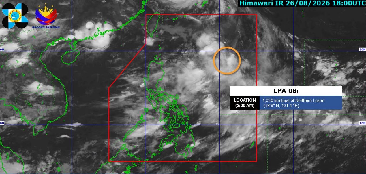
A low pressure area (LPA) being monitored inside the Philippine Area of Responsibility has a "medium chance" of developing into a tropical depression within the next 24 hours, PAGASA said.
In its 4 a.m. bulletin, the state weather bureau said the LPA was estimated at 1,030 kilometers East of Northern Luzon.
On Thursday, rains are expected to persist over Luzon and the western section of the Visayas due to the Southwest Monsoon or Habagat.
Zambales and Occidental Mindoro will have occasional rains brought about by Habagat.
The same weather system will bring cloudy skies with scattered rains and thunderstorms over Metro Manila, Ilocos Region, Cordillera Administrative Region, the rest of Central Luzon, Batanes, Cavite, Batangas, Rizal, Palawan, Antique, Iloilo, Guimaras, and Negros Occidental.
The rest of Luzon, Aklan, Capiz, and Negros Oriental will have partly cloudy to cloudy skies with isolated rainshowers or thunderstorms also due to Habagat.
The rest of the country will experience partly cloudy to cloudy skies with isolated rainshowers or thunderstorms as a result of localized thunderstorms.
Sunrise is at 5:44 a.m. and sunset is at 6:12 p.m. —LDF, GMA News

