


State weather bureau PAGASA on Thursday said the tropical storm with international name “Hagupit” may enter the Philippine area of responsibility (PAR) between Saturday and Sunday.
Once inside PAR, the tropical storm will be named locally as “Caloy.”
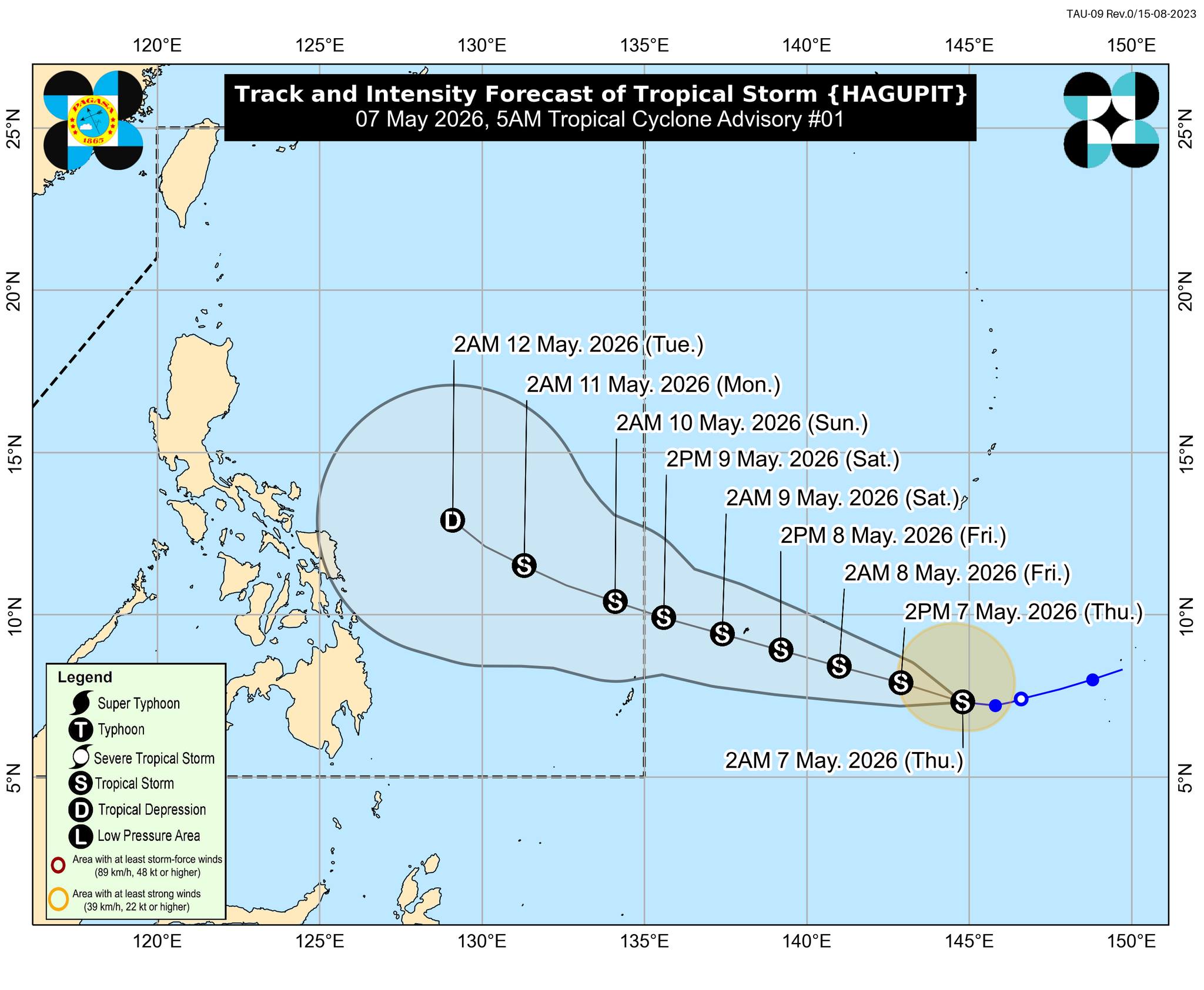
“It may enter the PAR between Saturday (09 May) evening and Sunday (10 May) morning and will be given a local name CALOY,” PAGASA said.
In its 5 a.m. tropical cyclone advisory, PAGASA said the center of Hagupit was estimated at 1,995 kilometers east of Northeastern Mindanao outside PAR.
The storm was packing maximum sustained winds of 65 kilometers per hour near the center and gusts of up to 80 kph. Its strong to gale-force winds extended up to 270 kilometers from the center.
Hagupit was moving westward at 20 kph.
PAGASA said Hagupit is expected to continue moving westward in the next six hours before turning west northwestward for the rest of the forecast period.
Hagupit may further intensify over the next 48 hours and could peak as a high-end tropical storm.
However, it may weaken afterward due to unfavorable environmental conditions and could be downgraded into a tropical depression by Tuesday while over the Philippine Sea.
Despite its movement toward PAR, PAGASA said Hagupit is “less likely to directly affect the weather and sea conditions in the next three days.”
Still, the agency advised the public and local disaster risk reduction and management offices to continue monitoring updates regarding the tropical cyclone.
(With reports from Joviland Rita, GMA News)
