






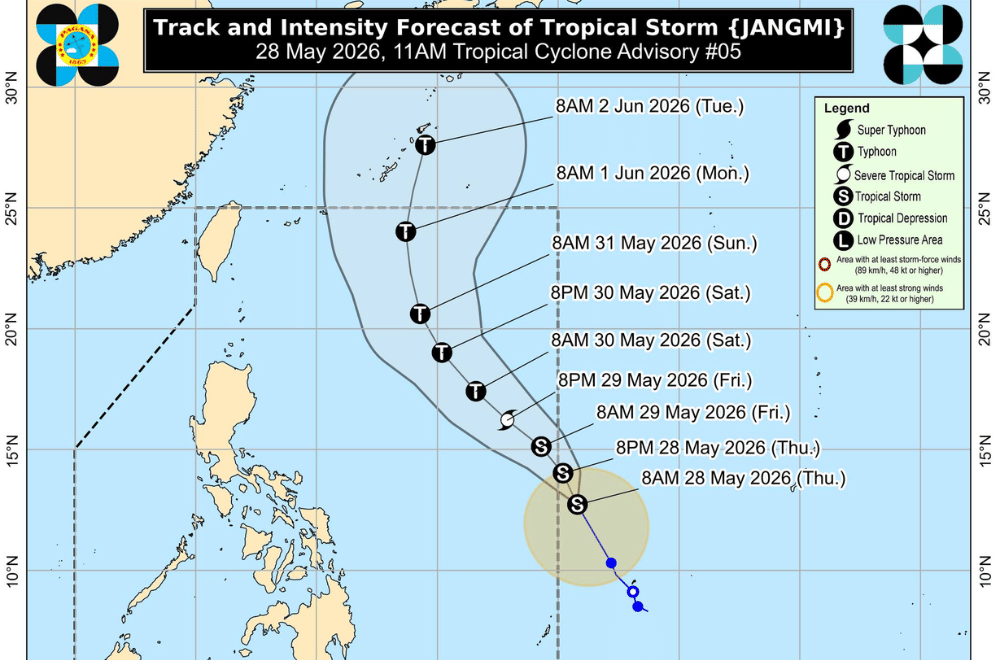
A tropical storm east of the Philippines is moving steadily north northwestward and is expected to enter the Philippine Area of Responsibility (PAR) within the next 24 hours, with forecasts showing further strengthening into a typhoon over the weekend, PAGASA said.
Tropical Storm Jangmi was estimated at 1,245 kilometers east of Eastern Visayas as of 10 p.m. on Wednesday, May 27, 2026. It packed maximum sustained winds of 65 km/h and was moving at 10 km/h toward the north northwest.
Once inside PAR between Thursday night and Friday morning, the system will be locally named “Domeng,” PAGASA said.
Forecast tracks show Jangmi continuing to intensify over the Philippine Sea, with a possible reach of typhoon category by Saturday and peak strength between Saturday and Sunday before weakening afterward.
While landfall is still not expected, the weather system may influence sea conditions over extreme Northern Luzon and enhance the southwest monsoon over the weekend, which could bring indirect weather impacts across parts of the country, PAGASA added.