


The Department of Environment and Natural Resources-SOCCSKSARGEN (DENR-12) is investigating the reported coastal uplift along the shore of Glan, Sarangani following the magnitude 7.8 earthquake that struck the province on June 8, 2026.
DENR-12 said the Sarangani Bay Protected Seascape-Protected Area Management Office (SBPS-PAMO) initially received reports from concerned residents in Glan town that the sea levels remained low and had not returned to its normal state since the earthquake.
Members of the Provincial Environment and Natural Resources Office (PENRO) Sarangani and CENRO Glan then began their ground validation and coastal survey despite the damaged road conditions.
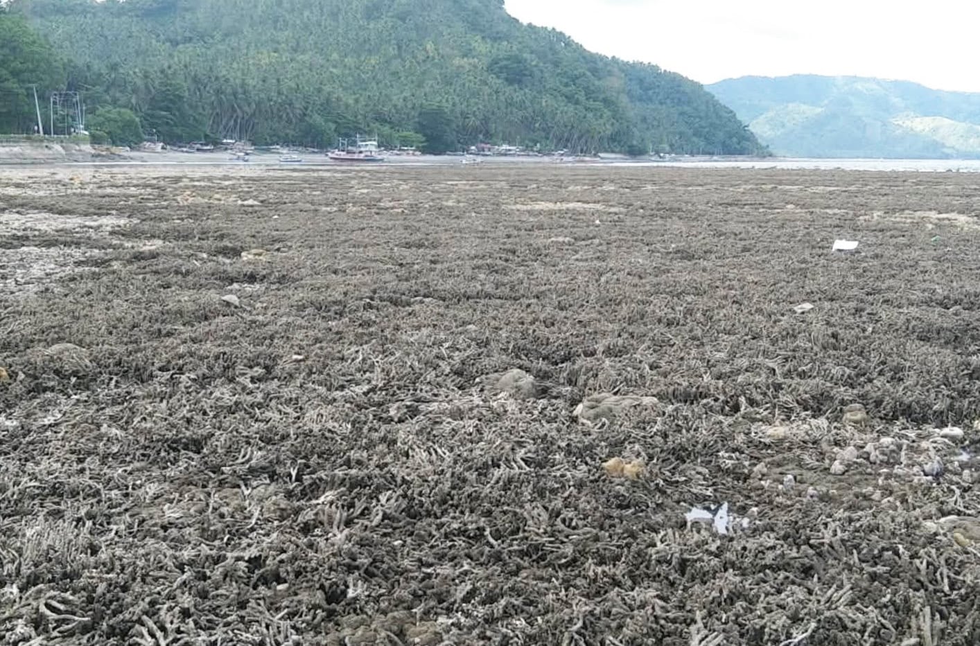
The team found that long stretches of shoreline, coral reef, and seagrass beds have been exposed, particularly in Pangyan Marine Sanctuary in Barangay Pangyan, Glan town.
DENR-12 said these exposed corals and seagrass beds, and marine organisms, including reef fishes, eels, clams, and shells had started to die.
Residents nearby raised concerns over the foul odor from the decaying marine life.
The Philippine Institute of Volcanology and Seismology (PHIVOLCS) earlier reported that based on initial observation, the coastal uplift in Barangay Pangyan had raised the seabed by two meters, and extended the shoreline by 200 meters, which exposed wide stretches of coral reefs and seagrass beds.
PHIVOLCS also reported that coastal uplift was also observed in parts of Jose Abad Santos, Davao Occidental.
SBPS-PAMO has deployed all its protected area rangers to document other possible cases of of coastal uplift and habitat damage around Sarangani Bay.
DENR-12 also formed a composite team with representatives from the Mines and Geosciences Bureau and partner local government units to conduct a scientific study of the Glan coastal uplift on Tuesday, June 16, 2026.
