


A magnitude 6.2 earthquake struck Davao Oriental on Monday, June 15, 2026, exactly a week after a powerful magnitude 7.9 quake hit neighboring Sarangani Province.
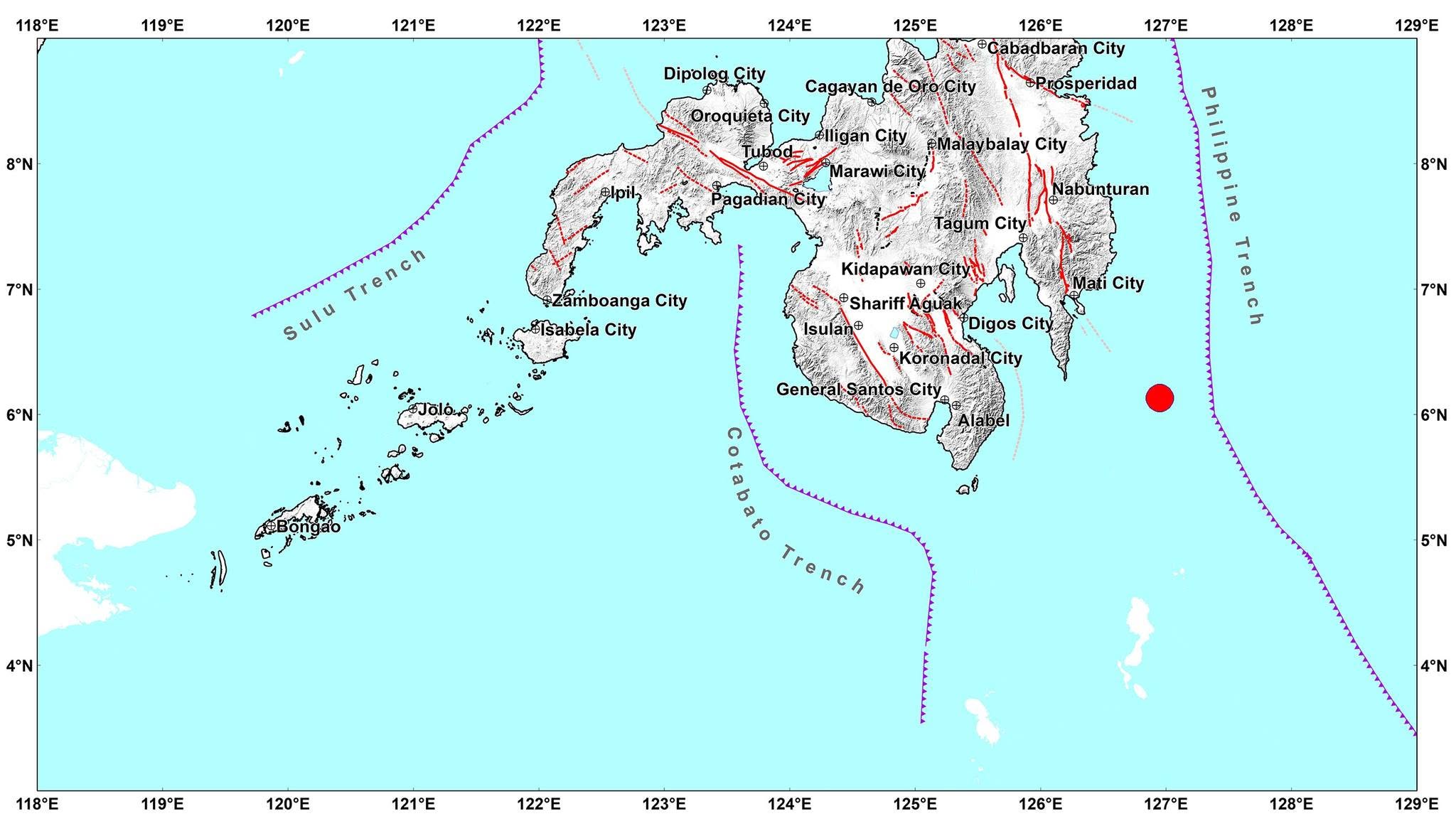
According to the Philippine Institute of Volcanology and Seismology (PHIVOLCS), the quake hit around 5:18 p.m., and its epicenter was located 06.13°N, 126.95°E - 113 km S 59° E of Governor Generoso.
The earthquake had a depth of 94 kilometers and was tectonic in origin.
It was first reported by PHIVOLCS as having magnitude 6.6 before downgrading it to magnitude 6.2.
Reported Intensities:
Intensity V - Governor Generoso, Davao Oriental; Jose Abad Santos, Davao Occidental
Intensity IV - Alabel, Glan, Kiamba, and Malapatan, Sarangani; City of Koronadal, Tampakan, and Tupi, South Cotabato; City of General Santos; City of Tacurong, Sultan Kudarat
Intensity III - City of Mati, Davao Oriental; Banga, Norala, Polomolok, Surallah, and T'Boli, South Cotabato
Intensity II - City of Davao; City of Kidapawan, M'lang, Matalam, and President Roxas, Cotabato; Maasim, and Maitum, Sarangani; Lake Sebu, Santo Niño, and Tantangan, South Cotabato
Intensity I - Carmen, Cotabato; City of Tandag, Surigao del Sur
Instrumental Intensities:
Intensity IV - City of Digos, Davao del Sur; Kiamba, Sarangani; City of Koronadal, and Tupi, South Cotabato
Intensity III - Nabunturan, Davao de Oro; Magsaysay, Davao del Sur; Maitum, Sarangani; Surallah, South; City of General Santos
Intensity II - City of Davao; City of Kidapawan, M'lang, and President Roxas, Cotabato; Malungon, Sarangani
Intensity I - Santa Maria, Davao Occidental; Carmen, Cotabato; Malapatan, Sarangani; T'Boli, South Cotabato
