


The Philippine Institute of Volcanology and Seismology (PHIVOLCS) has documented several impacts of liquefaction following the magnitude 7.8 earthquake that struck off the coast of Sarangani on June 8, 2026.
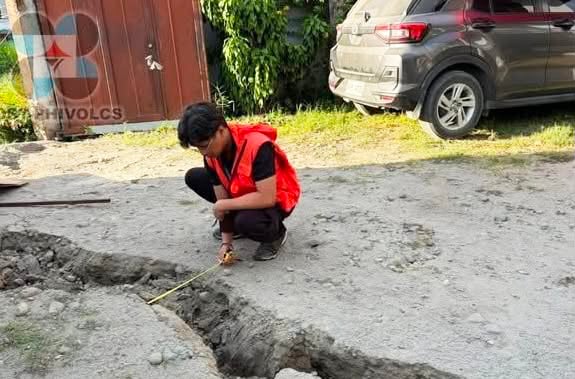
In a social media post on Tuesday, June 16, PHIVOLCS released images of the impacts of liquefaction, including ground fissures, sediment vents, road subsidence, and pavement displacement in parts of Sarangani Province and General Santos City.
PHIVOLCS said lateral spreads and sediment vents can be seen along the northern side of the Tuyan Rivermouth in Barangay Tuyan, Malapatan, Sarangani.
Road subsidence and pavement displacement were observed along the Datal Salvan-Bagong Silang Road in Sitio Datal Salvan, Barangay San Jose, General Santos City.
PHIVOLCS also noted ground fissure and sediment ejecta on the northern bank of the Lun Padidu River in Barangay Kawas, Alabel, Sarangani, and ground fissure caused by widespread liquefaction in Barangay Bula, General Santos City.
PHIVOLCS explained that liquefaction is an earthquake-related hazard in which water-saturated, sandy soil loses its strength and behaves like a liquid due to intense ground shaking.
This phenomenon can cause sand boils, ground fissures, subsidence, and lateral spreading that may damage land and infrastructure.
