






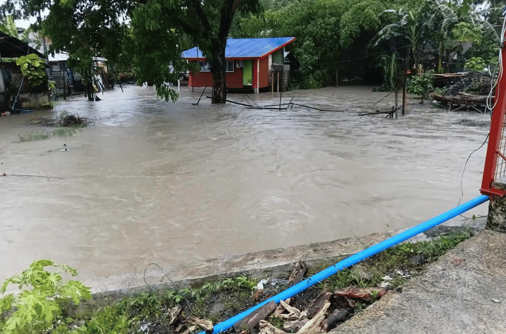
Heavy rains brought by Tropical Storm #KiyapoPH and the enhanced southwest monsoon inundated communities, damaged roads and bridges, and forced families to evacuate in several parts of the Philippines over the past 12 hours, as the storm moved closer to Extreme Northern Luzon on Friday, July 24, 2026.
FLOODING ACROSS REGIONS
In Isabela, heavy rain fell over the City of Ilagan, while Tuguegarao City and Calayan in Cagayan also experienced persistent rainfall as Kiyapo approached Northern Luzon.
In Western Visayas, floodwaters submerged parts of Lapaz District in Iloilo City after hours of continuous rain. Several families in Sibalom, Antique also sought shelter at a school after floodwaters entered their homes in Barangay Odiong.
In Central Visayas, heavy rain drenched Barangay Cantao-an in Naga City, Cebu, where streets were hit by continuous downpours.
In Mindanao, floodwaters entered several houses in Sitio Dabu, Barangay Nomoh, Maasim, Sarangani on Thursday, forcing residents to evacuate to safer areas. A strong surge of floodwaters also swept through a creek in Barangay Calumpang, General Santos City.
ROADS AND BRIDGE AFFECTED
Authorities also reported damage to key transport routes due to the heavy rains.
The Maladi Bridge in Lanao del Sur became unsafe and impassable after sustaining rain damage. The Malabang Municipal Disaster Risk Reduction and Management Office advised motorists and pedestrians to avoid the bridge while authorities conduct inspections and repairs.
In Sarangani Province, a landslide blocked a portion of the Maitum-Lake Sebu Road in Barangay Upo, Maitum, making it impassable to all vehicles as of Friday morning. The Department of Public Works and Highways in SOCCSKSARGEN said clearing operations were underway to restore access and urged motorists to avoid the affected road section.
Engineering personnel also carried out rapid response operations in flood-hit areas of Maasim, Sarangani.
WEATHER OUTLOOK
PAGASA said Kiyapo slightly intensified on Friday as it moved closer to Extreme Northern Luzon.
As of 10 a.m., the storm's center was estimated about 135 kilometers east of Aparri, Cagayan, packing maximum sustained winds of 75 kilometers per hour, gusts of up to 90 kph, and moving westward at 30 kph.
PAGASA said Kiyapo may pass close to the northeastern coast of mainland Cagayan before passing very close to or making landfall near the Babuyan Islands later Friday. The storm is expected to leave the Philippine Area of Responsibility by Saturday morning and could strengthen into a severe tropical storm, or even a typhoon, over the West Philippine Sea.
RAINFALL WARNING
PAGASA warned that Kiyapo could bring 100 to 200 millimeters of rain over Batanes, Cagayan, Apayao, and Ilocos Norte through Saturday noon, while 50 to 100 millimeters are forecast over Isabela, Kalinga, Abra, Benguet, Ilocos Sur, and La Union.
The enhanced southwest monsoon is also expected to dump 50 to 100 millimeters of rain over Occidental Mindoro, Palawan, Antique, Iloilo, Guimaras, and Negros Occidental through Saturday noon.
The weather bureau warned that rainfall could be heavier in mountainous areas and that previous rains may worsen flooding and landslides. It urged residents in high-risk areas to follow evacuation orders and other instructions from local authorities.
(with reports from Vincent John Abordo, Alwen Saliring, One North Central Luzon, Ratsada Balita, Balitang Bisdak, and One Mindanao)