

Rain over parts of Luzon forecast as Henry moves southwest
Rains may persist across parts of extreme northern Luzon due to Super Typhoon Henry, while the enhanced Southwest Monsoon may bring showers to the western part of the island, PAGASA said Wednesday evening.
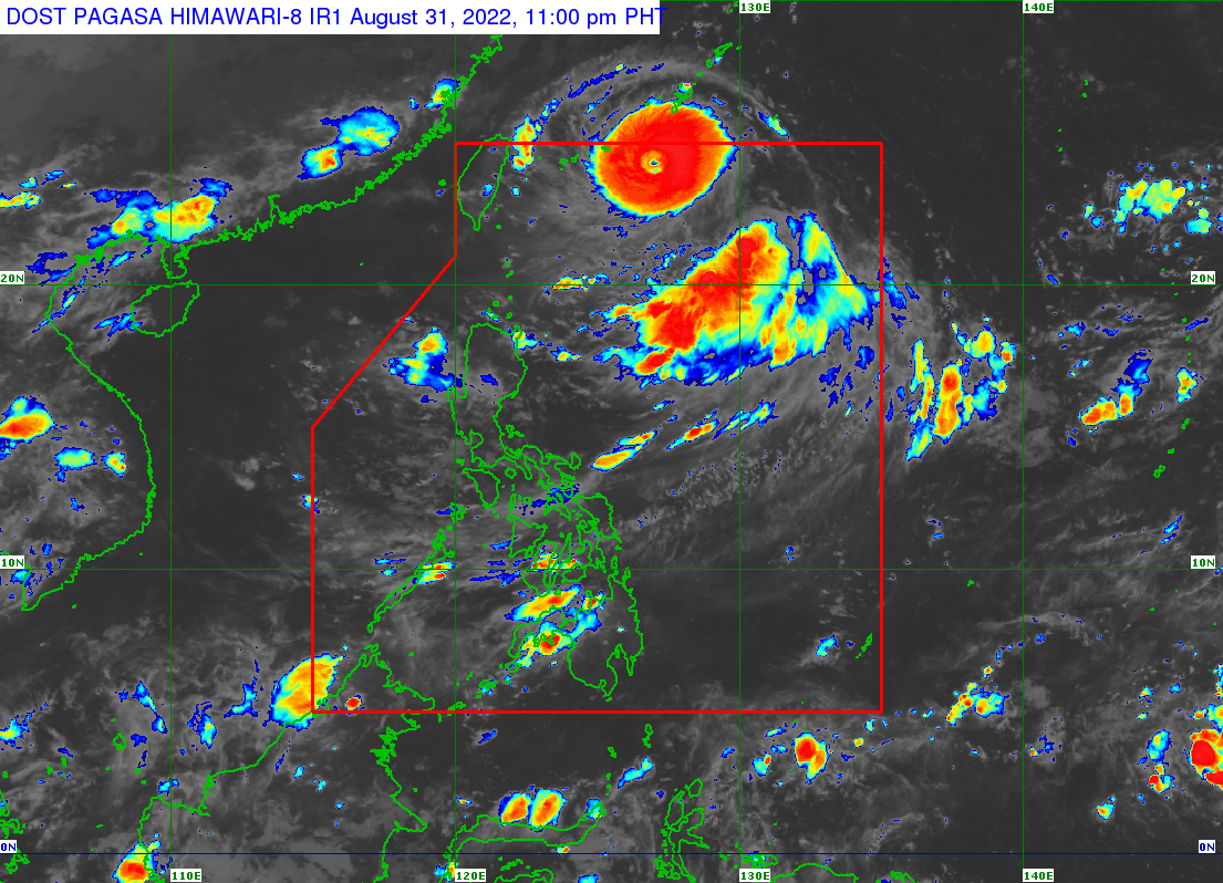
According to its 11 p.m. weather bulletin, the center of the eye of the storm known internationally as Hinnamnor was spotted 690 kilometers northeast of Itbayat, Batanes at 10 p.m.
It is moving west-southwestward at 25 kilometers per hour and has maximum sustained winds of 185 km/h near the center, gustiness of up to 230 km/h, and a central pressure of 930 hPa.
Henry entered the Philippine Area of Responsibility (PAR) at 5:30 p.m.
PAGASA said light to moderate with at times heavy rains may be experienced over Batanes and Babuyan Islands on Thursday afternoon to the evening due to the tropical cyclone. It may become moderate to heavy rains by Friday.
By Saturday, moderate to heavy rains are possible over Batanes while light to moderate with at times heavy rains may be experienced over Babuyan Island.
“Under these conditions, Isolated to scattered flooding (including flash floods) and rain-induced landslides are possible, especially in areas that are highly or very highly susceptible to these hazards as identified in hazard maps, and in localities with significant antecedent rainfall,” the weather bureau said.
As a result, residents in extreme northern Luzon have begun preparing for an onslaught, from reinforcing their homes to packing their things and moving their animals to higher ground.
“Habang wala pa, nagtatali [ng bubong] na kami para safety na kami. Pagtapos namin magtali dito pupunta ako sa bahay para magtali rin para safety ang pamilya namin,” Darwin Salamagos, a resident of Batanes, said in a 24 Oras report.
(While the typhoon is not yet here, we are starting to tie and secure our roofs for our safety. I will also secure our homes for the safety of our family.)
Habagat
PAGASA said Henry will also enhance the prevailing Southwest Monsoon (Habagat), which may trigger rains over the western section of Luzon.
The super typhoon is forecast to continue moving generally southwestward while decelerating. It is expected to become almost stationary by Thursday evening or Friday afternoon but may gradually accelerate as it heads north northwest direction and towards the southern portion of the Ryukyu Islands and into the East China Sea.
Henry is expected to exit PAR on Saturday evening or Sunday morning, PAGASA said.
Gardo
Tropical Depression Gardo, meanwhile, has accelerated while moving north north-westward east northeast of extreme northern Luzon.
In a separate 11 p.m. bulletin, PAGASA said the center of Gardo was last seen 1,040 kilometers east northeast of extreme northern Luzon. It is now heading north-northwestward at 20 kilometers per hour while packing maximum sustained winds of 55 kilometers per hour near the center and gustiness of up to 70 km/h.
No storm signals were raised over the country as the weather bureau maintained Gardo is unlikely to directly affect the country’s weather and sea conditions.
The tropical cyclone is forecast to move generally north-northwestward throughout the forecast period as it interacts with Super Typhoon Henry. Gardo may then degenerate into a remnant low within 12 hours as Henry begins to assimilate its circulation. — BM, GMA News
