

PHIVOLCS spots fault behind magnitude 6.9 earthquake in Cebu
State seismologists have spotted the fault that generated the magnitude 6.9 earthquake that struck Cebu on September 30.
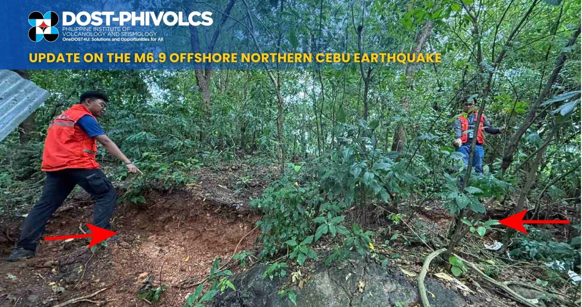
The Philippine Institute of Volcanology and Seismology (PHIVOLCS) said on Friday that its quick response team found the onland extension of the fault, the Bogo Bay Fault, in Sitio Looc, Barangay Nailon, in Bogo—the epicenter of the strongest earthquake ever recorded in northern Cebu.
“[T]he team observed fault scarps, open cracks, and small pressure mounds within a 2-meter-wide deformation zone. Initial field mapping recorded about 200 meters of surface rupture, while drone surveys revealed the fault may extend up to 1.5 kilometers, showing signs of right-lateral movement,” said PHIVOLCS in a statement.
PHIVOLCS said that field verification is ongoing to determine the full extent of the rupture.
At least eight significant earthquakes with magnitudes ranging from 5.0 to 7.2 had affected Cebu and nearby provinces between 1885 and 2013, PHIVOLCS said.
These include the magnitude 6.9 event in Negros Oriental on February 6, 2012, and the magnitude 7.2 event in Bohol on October 15, 2013.
At least 68 people died due to the September 30 earthquake, which also injured 559 individuals, the National Disaster Risk Reduction and Management Council said on Friday. The earthquake affected a total of 366,360 people, or 80,595 families. —VBL, GMA Integrated News
