

Signal No. 2 in 6 areas as Ramil moves to West Philippine Sea
Tropical Storm Ramil (international name: Fengshen) has moved over the West Philippine Sea and is expected to exit the Philippine area of responsibility on Monday morning, with several areas in Luzon still under Signal No. 2.
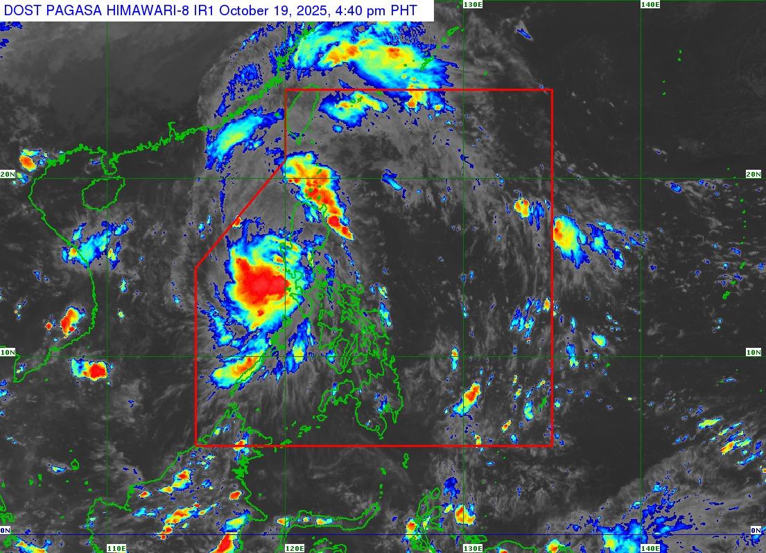
In an advisory released 5 p.m. on Sunday, October 19, the state weather bureau PAGASA said the center of Ramil was estimated 85 kilometers west northwest of Iba, Zambales, moving west northwestward at 35 kilometers per hour.
It was reported to have had maximum sustained winds of 65 kilometers per hour near the center, and gustiness of up to 80 kilometers per hour.
“On the forecast track, Ramil will continue moving west northwestward or nothwestward over the West Philippine Sea. It is forecast to exit the Philippine area of responsibility tomorrow (October 20) morning,” PAGASA said in a bulletin.
“Ramil may re-intensify over the West Philippine Sea and is forecast to reach severe tropical storm category while outside the PAR Region,” it added.
The following areas remain under Signal No. 2, indicating that winds of over 62 kilometers per hour to 88 kilometers per hour may be expected in at least 24 hours:
- The central and southern portions of La Union (Rosario, Pugo, Tubao, Santo Tomas, Agoo, Aringay, Caba, Naguilian, Burgos, Bagulin, Bauang, City of San Fernando, San Juan, San Gabriel, Bacnotan, Santol, Balaoan, Luna),
- the western and central portions of Pangasinan (Basista, Lingayen, Villasis, City of Alaminos, Anda, Malasiqui, San Fabian, Urbiztondo, Bautista, Mangaldan, Mapandan, Burgos, Dagupan City, Binalonan, Bolinao, Aguilar, Alcala, Sual, Labrador, Bani, Santo Tomas, Pozorrubio, City of Urdaneta, Laoac, Mangatarem, Mabini, San Carlos City, Manaoag, Binmaley, San Jacinto, Bugallon, Bayambang, Infanta, Agno, Calasiao, Santa Barbara, Dasol, Sison),
- Zambales,
- Tarlac,
- the western portion of Pampanga (Mexico, Porac, Angeles City, Santa Rita, Guagua, Sasmuan, Mabalacat City, Macabebe, Masantol, Santo Tomas, Minalin, City of San Fernando, Bacolor, Floridablanca, Magalang, Lubao), and
- the northern portion of Bataan (Dinalupihan, Hermosa, Orani, Samal, Abucay, Morong, Pilar, City of Balanga)
Signal No. 1 has been raised in the following areas, indicating winds of 39 to 61 kilometers per hour and intermittent rains expected in at least 36 hours:
- Cagayan including Babuyan Islands,
- Isabela,
- Quirino,
- Nueva Vizcaya,
- Apayao,
- Abra,
- Kalinga,
- Mountain Province,
- Ifugao,
- Benguet,
- Ilocos Norte,
- Ilocos Sur,
- the rest of La Union,
- the rest of Pangasinan,
- Aurora,
- the rest of Bataan,
- the rest of Pampanga,
- Nueva Ecija,
- Bulacan,
- Metro Manila,
- Rizal,
- the northern and central portions of Quezon (Pitogo, Buenavista, Lucena City, Calauag, Pagbilao, Infanta, Tiaong, Lopez, Catanauan, Guinayangan, Unisan, General Luna, Plaridel, Quezon, San Antonio, Alabat, Candelaria, Lucban, Sampaloc, Padre Burgos, Sariaya, City of Tayabas, Macalelon, Mauban, Dolores, General Nakar, Perez, Agdangan, Gumaca, Atimonan, Real, Tagkawayan) including Polillo Islands,
- Laguna,
- Cavite,
- Batangas,
- Occidental Mindoro including Lubang Islands,
- Oriental Mindoro,
- Marinduque, and
- the northern and western portions of Camarines Norte (Santa Elena, Capalonga, Jose Panganiban, Labo, Paracale)
— Jon Viktor D. Cabuenas/BM, GMA Integrated News
