

PAGASA: Cyclone signals still up over Palawan areas as Verbena intensifies
Tropical Storm Verbena has intensified as it moves west northwest over the Philippine Sea, PAGASA said Wednesday.
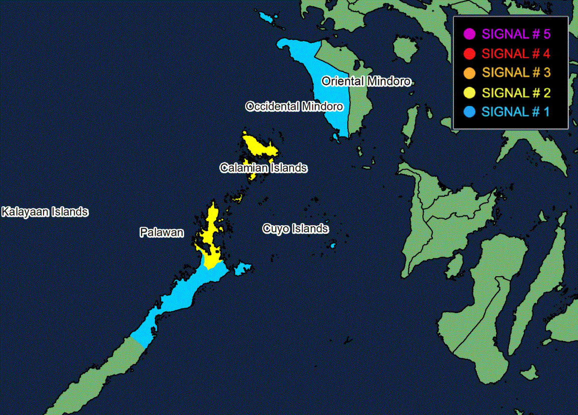
Signal No. 2 is still up over Calamian Islands and extreme northern portion of mainland Palawan (El Nido, Taytay).
Signal No. 1 is hoisted over Occidental Mindoro and the northern and central portions of Palawan (Dumaran, Roxas, San Vicente, Puerto Princesa City) including Cuyo and Kalayaan Islands.
The center of Verbena was estimated at 130 kilometers West of Coron, Palawan, moving west northwestward at 25 km/h with maximum sustained winds of 85 km/h near the center and gustiness of up to 105 km/h.
"It must be emphasized that heavy rainfall and severe winds may still be experienced in localities outside the landfall point and the forecast confidence cone," PAGASA said.
On the forecast track, Verbena will continue moving west northwestward over the West Philippine Sea Wednesday morning before moving westward and passing north of Kalayaan Islands in the afternoon and evening.
It will then exit the Philippine Area of Responsibility Thursday morning, and turn west southwestward from Thursday until Friday morning. Afterwards, Verbena will begin moving northwestward, then north northwestward over the sea east of Vietnam for the remainder of the forecast period.
PAGASA said Verbena may reach severe tropical storm category Wednesday afternoon and will continue to intensify until Thursday due to favorable environment. Afterwards, a weakening trend may occur due to the effect of the surge of the Northeast Monsoon. —GMA Integrated News
