

UP scientists identify behavior of Philippine cyclones over 25 years
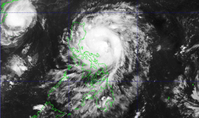
Experts from the University of the Philippines have found patterns in the behavior of storms approaching the country’s landmass, underscoring the need for urgent preparedness.
Examining 372 tropical cyclones (TCs) that made landfall from 1979 to 2024, Bernard Alan Racoma and Gerry Bagtasa of UP Diliman College of Science’s Institute of Environmental Science and Meteorology found patterns that occur in parts of the country.
“Storms that hit the northern part of the country tend to be stronger but slower-moving. Southern storms tend to be faster and accelerate more rapidly,” Racoma said.“This has implications for the kinds of hazards these storms may bring,” he said.
This means fast-moving and rapidly accelerating storms in the Visayas and Mindanao give communities limited time to prepare.Stronger yet slower-moving storms affecting Luzon amplify the risk of prolonged flooding and landslides.
The meteorologists also found that while storms often remain within the Philippine Area of Responsibility (PAR) for several days, their direct presence along the Philippine coasts is brief, typically lasting only 21 hours before moving inland or away.
One of the contributing factors, Racoma said, is the country’s geography.“Medyo balingkinitan ang Pilipinas. Mas pahaba ang bansa north-south, kumpara sa east-west. Since TCs usually move from east to west, they tend to cross this shorter path faster,” Racoma said.
(The Philippines is quite slender. The country is longer north-south than east-west. Since TCs usually move from east to west, they tend to cross this shorter path faster.)“Another possible explanation is because of the loss of the fuel source—the warm ocean. TCs draw their energy from the sea, and they typically don't like staying over land,” he added.
Meteorologists pointed out that understanding the storm’s timing and intensity helps reduce disaster risk.
They recommend that communities treat all developing storms seriously and monitor when TCs enter or form within the PAR.“Rapid intensification occurs very fast—typically within 24 hours. We don't yet fully understand it; even weak storms can intensify quickly,” Racoma said.
“We should avoid waiting for a storm to intensify before preparing. Half of TCs that form or enter the PAR make landfall, and usually rapid intensification occurs within this region,” he added.
The study titled “Characteristics and Near-Landfall Behavior of Tropical Cyclones Affecting the Philippines (1979–2024)” was published in the Tropical Cyclone Research and Review.
It is a journal that focuses on tropical cyclone monitoring, forecasting, research, and their related impacts on disaster risk reduction. –NB, GMA Integrated News
