

EXPLAINER: Meaning of PHIVOLCS alert levels per active volcano
The PHIVOLCS Volcano Alert Level Scheme is a guide to understanding the state of an active volcano, the current threat it poses, and the ways to ensure public safety.
An Alert Level represents the overall condition of a volcano depending on the severity of unrest.
The monitoring criteria indicate the observations on the volcano based on Volcano Observatories and scientific surveys.
Interpretation, according to PHIVOLCS, explains the "probable processes taking place within the volcano" and the potential dangers that may arise, while the recommendations are response measures to ensure public safety.
Step-down criteria, meanwhile, indicate the conditions that need to be considered before lowering the alert level.
Here are the Alert Level interpretations and recommendations for each active volcano PHIVOLCS is monitoring:
BULUSAN
-Alert Level 0 (Quiet or No Alert)
No magmatic eruption is foreseen, but there are hazards like explosions, rockfalls, and landslides that may suddenly occur within the four-kilometer radius Permanent Danger Zone (PDZ).
-Alert Level 1 (Low Level of Volcanic Unrest)
The source of activity is shallow, near the crater or in the vicinity of Irosin Caldera. Entry into the PDZ must be prohibited.
-Alert Level 2 (Moderate Level of Volcanic Unrest)
There is a probable intrusion of magma at depth, which can lead to a magmatic eruption is being monitored. Entry within PDZ must be prohibited. Other areas within 5 kilometers of the active vent may be included in the danger zone.
-Alert Level 3 (High Level of Volcanic Unrest)
Magma is near or at the surface, and activity could lead to a hazardous eruption in weeks. Danger zones may be expanded up to eight 8 kilometers from the active crater.
-Alert Level 4 (Hazardous Eruption in Progress)
Magmatic processes or effusive eruption are underway, which can progress into a highly hazardous eruption. Danger Zone may be extended up to 9 kilometers or more from the active crater.
-Alert Level 5 (Hazardous Eruption in Progress)
A life-threatening eruption producing volcanic hazards is present, which can endanger communities. Additional danger areas may be declared as the eruption progresses.
HIBOK-HIBOK
-Alert Level 0: No eruption in foreseeable future
-Alert Level 1: Magmatic, tectonic, or hydrothermal disturbance; no eruption imminent.
-Alert Level 2: Probable magmatic intrusion; could eventually lead to an eruption.
-Alert Level 3: Increasing likelihood of an eruption, possibly within days to weeks.
-Alert Level 4: Magma close to or at earth’s surface. Hazardous explosive eruption likely, possible within hours to days
-Alert 5: Explosive eruption in progress. Hazards in valleys and downwind
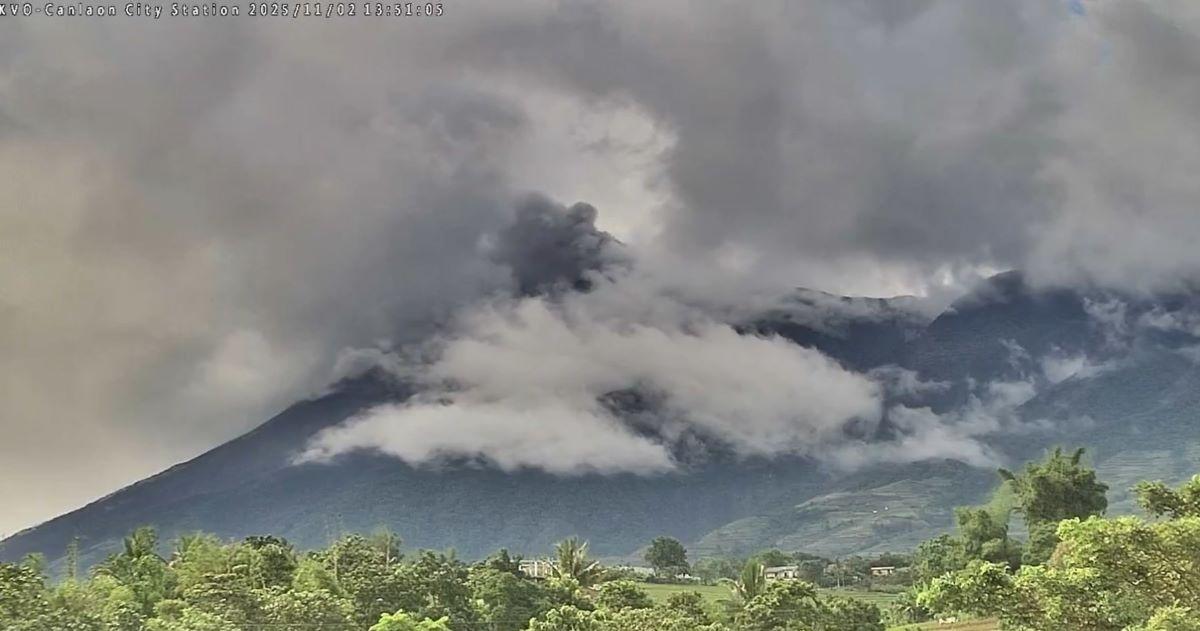
KANLAON, MAYON
-Alert Level 0 (No Alert or Normal)
There is no magmatic eruption foreseen. However, perennial hazards or sudden explosions, rockfalls, and landslides may suddenly occur within the 4-kilometer-radius PDZ
-Alert Level 1 (Low Level of Volcanic Unrest)
Hydrothermal, magmatic, or tectonic disturbances may be underway. The source of activity may be shallow, near the summit crater, or in the vicinity of the edifice. Entry into the PDZ must be prohibited.
-Alert Level 2 (Moderate Level of Volcanic Unrest)
Probable intrusion of magma at depth, which may or may not lead to magmatic eruption. Entry within PDZ must be prohibited.
-Alert Level 3 (High Level of Volcanic Unrest)
Magmatic intrusion to shallow levels of the edifice is driving unrest, with indications that a hazardous eruption could occur in weeks. Danger zones may be expanded to a radius of 6 kilometers from the summit crater or active vent.
-Alert Level 4 (Hazardous Eruption Imminent)
Low-level magmatic eruption underway, which can progress to a highly hazardous major eruption within hours or days. Danger zones may be expanded to a radius of 10 kilometers or more from the summit crater or active vent.
-Alert Level 5 (Hazardous Eruption in Progress)
Life-threatening major eruption producing volcanic hazards that endanger communities. Danger zones may be expanded to fourteen 14 kilometers as the eruption progresses.
TAAL
-Alert Level 0 (No Alert or Normal)
No major eruption in the foreseeable future, but steam-driven and gas eruptions can occur without warning. Permanent habitation on Taal Volcano Island (TVI) must not be allowed.
--Alert Level 1 (Low Level of Volcanic Unrest)
Hydrothermal or tectonic activity beneath the volcano may be occurring; steam-driven, gas, or hydrothermal explosions can occur without warning.
Entry into the TVI Main Crater, the Daang Kastila fissure are,a and the Mt. Tabaro eruption site must not be allowed.
-Alert Level 2 (Increasing Unrest)
Shallow hydrothermal unrest and/or deep-seated magmatic intrusion may be occurring, bringing higher chances of steam-driven, gas or hydrothermal explosions.
Entry into TVI must not be allowed. Communities in pre-defined areas of the highest hazard must be ready for possible evacuation.
-Alert Level 3 (Intensified Unrest/ Magmatic Unrest)
Magmatic or explosive phreatomagmatic eruption is imminent; precursory eruptive activity may be taking place and generating ashfall, ballistics, and/or short lava flows.
TVI, Taal Lake, and pre-defined lakeshore communities of Batangas facing the active vent must be evacuated.
-Alert Level 4 (Hazardous Eruption Imminent)
A strong phreatomagmatic or magmatic eruption is taking place, which may or may not lead to a violently explosive eruption. Widespread ashfall and ballistics, lava flows, and minor pyroclastic density currents (PDCs) on TVI may be generated.
Communities in pre-determined worst-case or scenario-based volcanic hazards zones must be evacuated
-Alert Level 5 (Highly Hazardous Eruption in Progress)
Plinian/ Subplinian/ Violent phreatomagmatic eruption is taking place. Extreme life-threatening hazards of base surges/PDCs, volcanic tsunamis, thick tephra fall/ashfall, fissuring, lahars, and landslides could impact communities around the lake and downwind of the eruption plume.
Additional areas for evacuation should be considered based on prevailing conditions.
PINATUBO
-Alert Level 0 (Normal)
No major eruption in the foreseeable future. Communities at risk must continue preparedness efforts.
-Alert Level 1 (Low-Level Unrest)
Local tectonic activity beneath/near the volcano may be occurring; no eruption is imminent. Extreme caution is recommended when venturing into the Pinatubo Caldera.
-Alert Level 2 (Increasing Unrest)
Deep-seated magmatic intrusion and/ or increased hydrothermal activity may be occurring, with increased chances of phreatic, gas or hydrothermal explosions; could eventually lead to an eruption.
No entry into Pinatubo Caldera; Preparation of communities in case of escalation of unrest.
-Alert Level 3 (Intensified unrest/ Magmatic Unrest)
Certain magmatic intrusion into the shallow magma system or edifice, with higher chances of a major eruption; precursory eruptive activity due to disruption of the hydrothermal system; lava dome growth may occur.
Evacuation of upland communities up to 10 kilometers from the summit caldera.
-Alert Level 4 (Hazardous Eruption Imminent)
Phreatomagmatic or pre-climactic magmatic eruption; If magma ascent rates increase, highly explosive eruption is probable within hours to a few days; if magma ascent rates decrease, prolonged lava dome growth may occur.
Evacuation of communities within pre-determined hazard zones for PDCs, heavy ashfall, and syn-eruption lahars.
-Alert Level 5 (Highly Hazardous Eruption in Progress)
Climactic Subplinian to Plinian eruption; Volcanic hazards expected within a 30-kilometer radius of the crater and downwind of the eruption plume.
Evacuation of additional communities, downwind of the eruption plume, along major river systems, and in buffer extensions of hazard zones. —VBL, GMA Integrated News
