

EXPLAINER: What is the Pacific Ring of Fire's link to earthquakes?
The Philippines, which lies along the Pacific Ring of Fire, records an average of 20 earthquakes a day, according to the Philippine Institute of Volcanology and Seismology (PHIVOLCS).
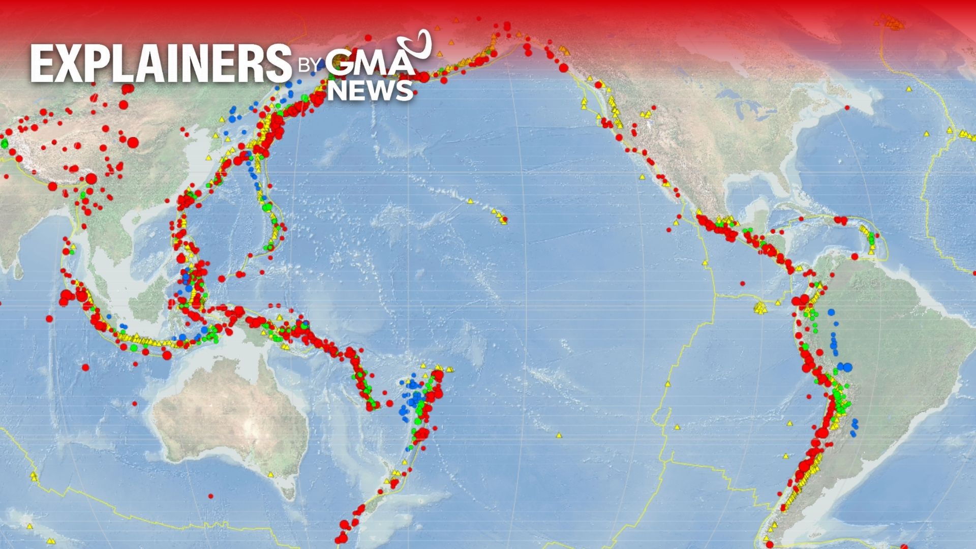
The Pacific Ring of Fire is a 40,000-kilometer horseshoe-shaped belt that surrounds much of the Pacific Ocean and is home to many of the world's active volcanoes and earthquake zones, PHIVOLCS said.
Its designation as an "active" region means earthquakes, volcanic eruptions, and tsunamis frequently occur due to the movement and interaction of tectonic plates.
Oceanic trenches
According to the U.S. Geological Survey (USGS), the Ring of Fire is composed not only of volcanic arcs but also of oceanic trenches — deep underwater subduction zones formed when tectonic plates collide.
Subduction occurs when an oceanic plate converges with another plate and sinks beneath it. This process can generate powerful earthquakes and tsunamis.
Cotabato Trench
On Monday, June 8, a magnitude 7.8 earthquake struck off Sarangani Province, disrupting the opening day of classes and other activities in parts of Mindanao.
PHIVOLCS said scientists are investigating whether the quake was generated by the Cotabato Trench, which it described as a highly active seismic feature.
"Based on the location of the earthquake, focal mechanism, and aftershock distribution, the earthquake may be attributed to subduction along the Cotabato Trench," PHIVOLCS said in an incident primer.
PHIVOLCS explained that Sarangani and nearby provinces frequently experience earthquakes because they are located in one of the country's most seismically active regions.
The agency added that the Cotabato Trench, along with several active faults in the area, is capable of generating minor to major earthquakes.
"The coast of Sarangani faces the Cotabato Trench, a major earthquake-generating structure. Additionally, there are local faults in proximity, some potentially concealed by recent deposits," PHIVOLCS said.
PHIVOLCS Director Dr. Teresito Bacolcol noted that this year marks the 50th anniversary of the devastating 1976 Moro Gulf earthquake and tsunami.
The Aug. 17, 1976 earthquake, which measured magnitude 8.1, struck near the Moro Gulf along the Cotabato Trench and triggered a tsunami that killed an estimated 8,000 people across Mindanao.
The disaster remains one of the deadliest earthquakes and tsunamis in Philippine history.—MCG, GMA News
