

Nighttime brightness declined in parts of Mindanao following earthquake - PhilSA
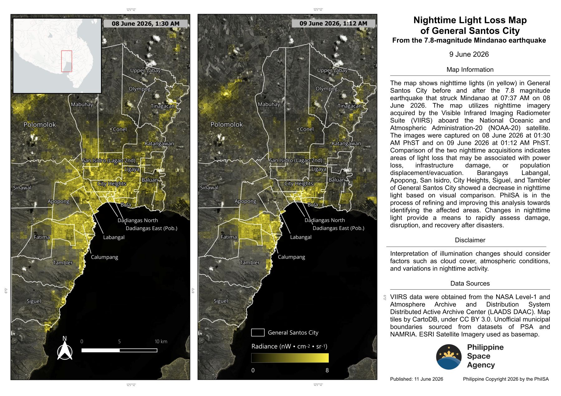
The Philippine Space Agency (PhilSA) has released nighttime satellite data that may indicate the extent of damage caused by the magnitude 7.8 earthquake that struck offshore Sarangani in Mindanao on June 8.
PhilSA compared nighttime satellite images taken at 1:30 a.m. on June 8 and 1:12 a.m. on June 9. According to the agency, areas showing an absence or reduction of light may indicate power outages, infrastructure damage, or population displacement.
“Changes in nighttime light provide a means to rapidly assess damage, disruption, and recovery after disasters. When lights go out, it often signals power loss, infrastructure damage, or population displacement or evacuation,” PhilSA said.
“This preliminary analysis presents a proxy for identifying areas that may have sustained the most damage based on the absence of nighttime light,” it added.
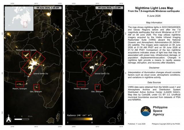
Based on the analysis, areas that showed a decline in nighttime brightness included Barangays Labangal, Apopong, San Isidro, City Heights, and the coastal barangays of Siguel and Tambler in General Santos City; the coastal municipalities of Maasim and Glan in Sarangani; and Polomolok in South Cotabato.
However, PhilSA said that changes in illumination may also be influenced by factors such as cloud cover, atmospheric conditions, and variations in nighttime activity.
The death toll from the earthquake rose to 47 as of Thursday, according to the National Disaster Risk Reduction and Management Council (NDRRMC). More than 346,000 people have been affected by the disaster. —VBL, GMA News
