

 GMA Brandtalk
 Tracking
 Archives

PhilSA maps using satellite show extent of Mindanao floods due to Typhoon Inday
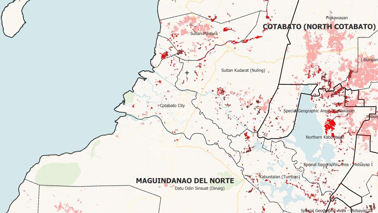
The Philippine Space Agency (PhilSA) on Sunday shared maps it produced using satellite data to show the extent of floods caused by Typhoon Inday and enhanced monsoon rains.
In a news release, flood extent maps shows flooded areas (red) and flood-affected Physical Rice Areas (pink) and Other Crop Areas (brown) in Regions 9, 10, 11, 12, and Bangsamoro Autonomous Region in Muslim Mindanao (BARMM) following the enhanced monsoon due to Typhoon Inday.
PhilSA said “the analysis used Sentinel-1 Synthetic Aperture Radar (SAR) satellite imagery captured on 10 July 2026 at approximately 05:31 AM PhST. The flooded areas were detected with the aid of Artificial Intelligence (AI) using a composite of three Sentinel-1 SAR images.”
SAR satellite imagery is useful in flood mapping because SAR signals can penetrate through clouds that often cover large areas during storms, and regardless of daylight conditions, unlike optical imagery. However, SAR may underestimate flooding in urban and densely vegetated areas because complex surfaces may affect the backscatter data being measured and reduce flood detection accuracy. Please note that these maps remain subject to ground validation,” the agency explained.
PhilSA said the initiative supports the National Disaster Risk Reduction and Management Council (NDRRMC) in monitoring the situation and prioritizing areas for response through the analysis of wide-area coverage satellite data.
“By making space data accessible to stakeholders, PhilSA enables informed decision-making and strengthens disaster response,” PhilSA said as it continues to monitor satellite data as the situation requires.
Access the maps and shapefiles of flood extents here.
The Philippine Space Agency (PhilSA) is the central government agency of the Philippines that plans, develops, and promotes the national space program in line with the Philippine Space Policy. Created in August 2019 under Republic Act No. 11363, or the Philippine Space Act, PhilSA is an attached agency of the Office of the President of the Philippines for purposes of policy and program coordination and to ensure alignment in national policies and priorities. —RF, GMA News
