

Signal No. 1 up over parts of Luzon as Rolly continues to traverse West Philippine Sea
Tropical Cyclone Wind Signal No. 1 was raised over parts of Luzon on Monday as Tropical Storm Rolly (international name: Goni) continues to traverse the West Philippine Sea.
Areas under TCWS No. 1 are:
- the northwestern portion of Occidental Mindoro (Paluan, Mamburao, Abra de Ilog) including Lubang Island
- the western portion of Batangas (Tingloy, Mabini, Bauan, San Luis, Taal, Agoncillo, San Nicolas, Santa Teresita, Talisay, Laurel, Lemery, Calaca, Balayan, Calatagan, Tuy, Lian, Nasugbu)
- the extreme western portion of Laguna (San Pedro City, Biñan City
- Cavite
- Metro Manila
- the western portion of Bulacan (San Jose del Monte City, Santa Maria, Pandi, Bustos, Baliuag, Marilao, Meycauayan City, Obando, Bocaue, Bulacan, Balagtas, Guiguinto, Pulilan, Plaridel, Malolos City, Paombong, Hagonoy, Calumpit)
- the western portion of Pampanga (San Luis, Mexico, Masantol, Sasmuan, Floridablanca, Lubao, Porac, Guagua, Santa Rita, Bacolor, Angeles City, Santo Tomas, San Fernando City, San Simon, Macabebe, Minalin, Apalit)
- Bataan
- the southern portion of Zambales (San Marcelino, San Felipe, San Narciso, San Antonio, Castillejos, Subic, Olongapo City)
These areas will experience winds of 30 to 60 km/h which may be expected in at least 36 hours or intermittent rains may occur within 36 hours.
Areas under TCWS No. 1 as well as Batanes, Babuyan Islands, Ilocos Region, Cordillera Administrative Region, and the northern portions of mainland Cagayan and Zambales will have strong breeze to near gale conditions with occasional gusts.
Coastal waters
The seaboards of Northern Luzon and Central Luzon, the western seaboards of Batangas, Occidental Mindoro including Burias Island, and Calamian Islands, and eastern seaboards of Quezon including Polillo Islands and the Bicol Region will have rough to very rough seas.
These areas will have waves reaching up to 5 meters, making sea travel risky, especially for those with small seacraft.
Meanwehile, the western seaboards of Palawan including Kalayaan Islands and the eastern seaboards of Visayas and Mindanao will have moderate to rough seas with waves up to 2.5 meters.
Those with small seacraft are advised to take the necessary precautions when going out to sea.
PAGASA advised inexperienced mariners not to navigate given these conditions.
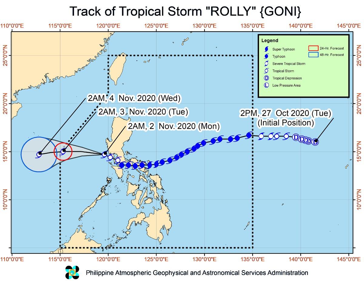
At 4 a.m., the center of Rolly was located at 100 km west southwest of Subic Bay.
It is moving west northwestward at 20 km/h.
Rolly has maximum sustained winds of 65 km/h near the center and gustiness of up to 80 km/h.
The former super typhoon is expected to exit the Philippine Area of Responsibility on Tuesday morning.
PAGASA advised the public and disaster risk reduction and management councils concerned to take the necessary precautions and await the next severe weather bulletin at 11 a.m. —KG, GMA News
