

Tonyo makes landfall over Batangas; Signal No. 1 up over 15 areas
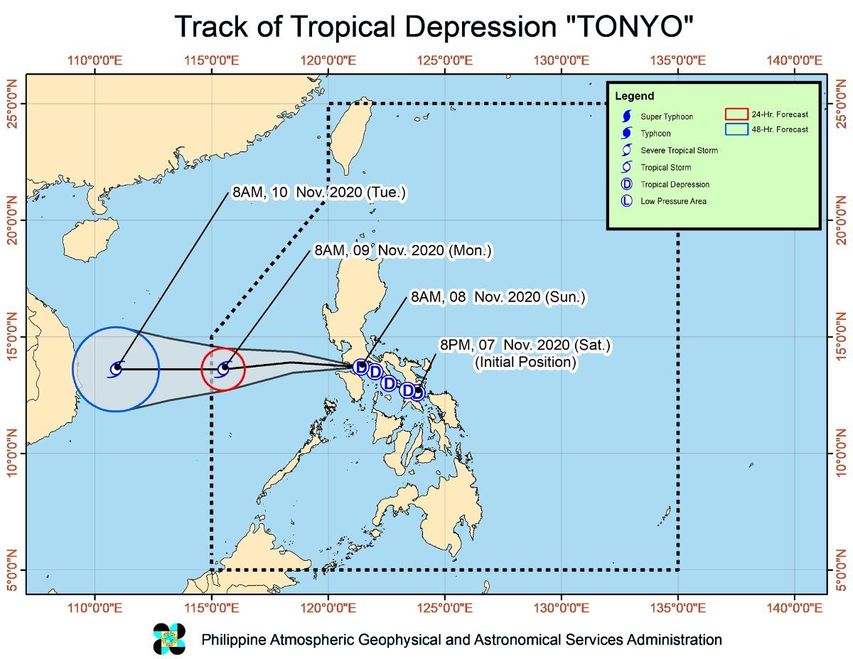
Tropical Cyclone Wind Signal No. 1 remains hoisted over several areas in Luzon before noon on Sunday as Tropical Depression Tonyo continued moving west northwestward toward the West Philippine Sea after it made landfall over San Juan, Batangas.
TCWS No. 1 is in effect over these areas as of 11 a.m.:
- The northern and central portions of Quezon (Gumaca, Pitogo, Quezon, Alabat, Perez, Unisan, Plaridel, Atimonan, Agdangan, Padre Burgos, Pagbilao, Mauban, Tayabas City, Lucena City, Sariaya, Candelaria, Tiaong, San Antonio, Dolores, Lucban, Sampaloc, Real, Infanta, General Nakar) including Polillo Islands
- Cavite
- Laguna
- Rizal
- Batangas
- Metro Manila
- Bataan
- Bulacan
- Pampanga
- the southern portion of Aurora (Dingalan)
- the southern portion of Zambales (San Marcelino, San Felipe, San Narciso, San Antonio, Castillejos, Subic, Olongapo City)
- Marinduque
- the northern portion of Romblon (Romblon, San Andres, Calatrava, San Agustin, Corcuera, Banton, Concepcion)
- the northern and central portions of Oriental Mindoro (Bongabong, Bansud, Gloria, Pinamalayan, Socorro, Pola, Naujan, Victoria, Calapan City, Baco, San Teodoro, Puerto Galera)
- the northern and central portions of Occidental Mindoro (Sablayan, Santa Cruz, Mamburao, Paluan, Abra de Ilog) including Lubang Island
Areas under TCWS No. 1 will experience winds of 30-60 km/h in at least 36 hours, or intermittent rains within 36 hours.
As Tonyo passes, these areas may have strong breezes to near gale conditions with occasional gusts.
Location
At 10 a.m., the eye of Tonyo was located in the vicinity of Lobo, Batangas. It made landfall in the area earlier at 8 a.m.
Tonyo has maximum sustained winds of 45 km/h near the center and gustiness of up to 60 km/h.
It is moving west northwestward at 25 km/h over the Batangas-Cavite area.
Tonyo is expected to emerge over the West Philippine Sea on Sunday morning or afternoon.
It is forecast to exit the Philippine Area of Responsibility on Monday morning.
The tropical depression is also seen to become stronger and develop into a tropical storm within the next 24 hours.
Rainfall, winds
The Ilocos Region, Cordillera Administrative Region, Cagayan Valley, Aurora, the northern portion of Quezon including Polillo Islands, Rizal, Laguna, Cavite, Batangas, Mindoro Provinces, and Palawan including Calamian and Kalayaan Islands will have light to moderate to at times heavy rains on Sunday due to Tonyo.
Meanwhile, Batanes, Babuyan Islands, Ilocos Norte, Apayao and the northern portion of mainland Cagayan will have strong breeze to near gale conditions due to the Northeast Monsoon (Amihan).
Coastal waters
The seas will be moderate to rough, with waves up to 3.5 meters, over the seaboards of areas under TCWS No. 1, the eastern seaboards of Cagayan Valley, Aurora, and the northern portion of Quezon, as well as the northern and eastern seaboards of Catanduanes. This is due to Tonyo and the easterlies.
PAGASA said those with small seacraft should take the necessary precautions when venturing out to sea. Those without much experience should avoid navigating in these conditions.
The seaboards of Batanes, Ilocos Norte, and Ilocos Sur and the northern seaboard of Cagayan including Babuyan Islands will have rough to very rough seas, with waves reaching up to 4.5 meters. This is due to the Northeast Monsoon.
"Sea travel is risky over these waters, especially for mariners of small seacrafts," the weather bureau said.
PAGASA advised the public and disaster risk reduction and management councils concerned to take the necessary precautions.
The next severe weather bulletin will be issued by PAGASA at 2 p.m. —KG, GMA News
