

Signal No. 1 over Pangasinan, Zambales as Jolina moves away from Luzon
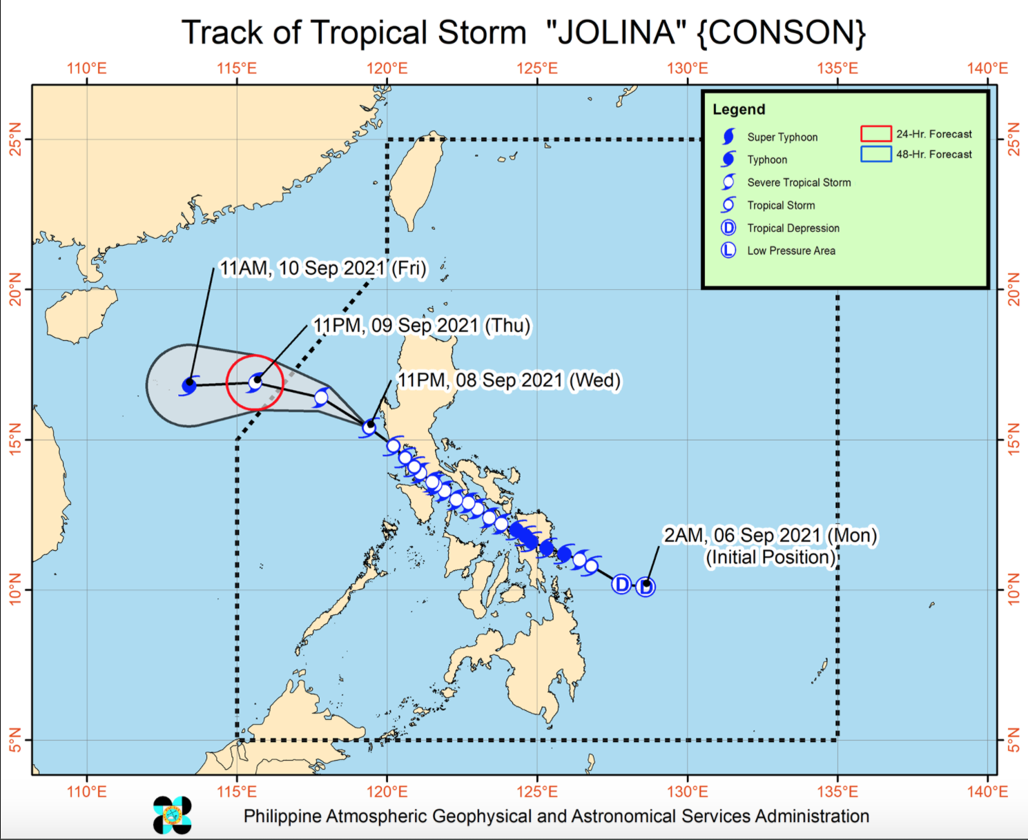
Tropical Storm Jolina maintains strength while moving northwestward away from the landmass of Luzon, PAGASA reported in its latest Severe Weather Bulletin posted 5 a.m. on Thursday.
Pangasinan and Zambales will have rains with gusty winds brought about by Jolina with possible flash floods or landslides due to moderate to heavy rains that may cause very light to light damage to structures and vegetation due to moderate to strong winds.
Tropical Cyclone Wind Signal (TCWS) No. 1 is hoisted over the following areas:
- the western portion of Pangasinan (Anda, Bolinao, Infanta, Aguilar, Sual, Labrador, Dasol, Bugallon, Burgos, Mabini, Agno, City of Alaminos, Bani, Lingayen, Mangatarem)
- the northern portion of Zambales (San Antonio, Botolan, San Narciso, San Felipe, Cabangan, Palauig, Iba, Masinloc, Candelaria, Santa Cruz)
The center of Tropical Storm Jolina was estimated at 145 kilometers west northwest of Iba, Zambales or 175 km West of Dagupan City, Pangasinan with maximum sustained winds of 85 kilometers per hour near the center with gustiness of up to 115 kph, central pressure of 998 hPa, and moving northwestward at a speed of 25 kph.
Western Visayas, Zamboanga Peninsula, Palawan, Occidental Mindoro, Oriental Mindoro, Romblon, Basilan, Sulu and Tawi-Tawi will have monsoon rains brought about by the southwest monsoon with possible flash floods or landslides due to light to moderate with at times heavy rains.
Metro Manila, and the rest of Luzon and Visayas will have cloudy skies with scattered rainshowers and thunderstorms due to the southwest monsoon with possible flash floods or landslides during severe thunderstorms.
The rest of Mindanao, meanwhile, will have partly cloudy to cloudy skies with isolated rainshowers or thunderstorms due to southwest monsoon with possible flash floods or landslides during severe thunderstorms.
On the forecast track, Jolina will move northwestward today over the West Philippine Sea and exit the Philippine Area of Responsibility (PAR) on Thursday afternoon or evening.
Outside the PAR, the storm is forecast to move generally westward towards the vicinity of Vietnam or southern China.
Jolina is also forecasted to re-intensify and reach severe tropical storm category today and reach typhoon category on Friday.
