

Lannie to exit PAR in a few hours
Tropical Depression Lannie is about to exit the Philippine Area of Responsibility (PAR), PAGASA reported.
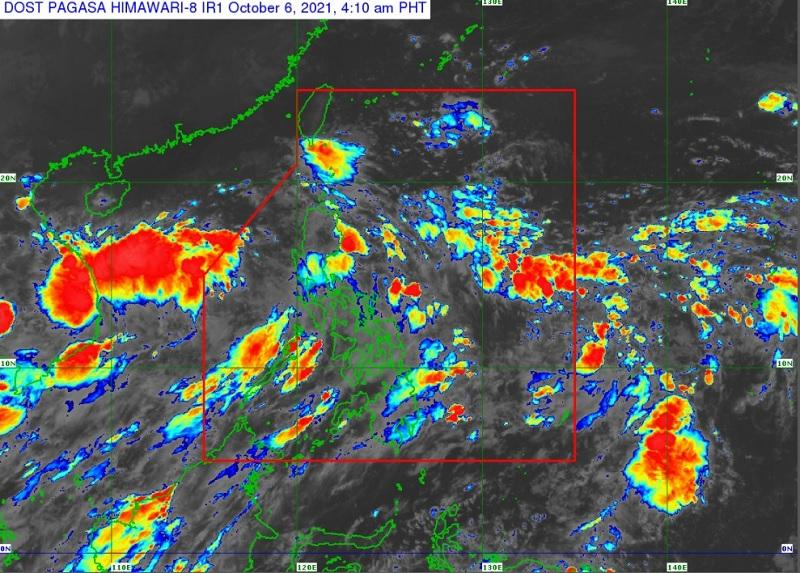
The center of Tropical Depression Lannie was estimated at 670 kilometers west of Calapan City, Oriental Mindoro with maximum sustained winds of 45 kilometers per hour near the center, gustiness of up to 55 kph, central pressure of 1002 hPa, and moving west northwestward at 25 kph.
No Tropical Cyclone Wind Signal is currently in effect, the weather bureau reported.
Metro Manila, Central Luzon, CALABARZON, and MIMAROPA will have cloudy with scattered rainshowers and thunderstorms brought about by the trough of the tropical depression with possible flash floods or landslides due to moderate to at times heavy rains.
The rest of the country will have partly cloudy to cloudy skies with isolated rainshowers or thunderstorms due to the trough of the tropical depression / localized thunderstorms with possible flash floods or landslides due to severe thunderstorms.
In the next 24 hours, the enhanced easterlies while bring occasional gusts reaching near gale to at times gale force over extreme northern Luzon, while the enhanced southwesterlies will bring the same conditions over the coastal and upland/mountain areas along the western section of Central and Southern Luzon.
A Gale Warning is currently in effect over the seaboards of Northern Luzon and the western seaboards of Southern Luzon.
Moderate to rough seas will prevail over the remaining western seaboard of Luzon and the eastern seaboard of the country, which is risky for those using small seacrafts. Mariners are advised to take precautionary measures when venturing out to sea and, if possible, avoid navigating in these conditions.
Lannie is forecast to exit the PAR region within the 2 to 3 hours. -- BAP, GMA News
